Spotter Scout
Starting at $XXX
Trusted Spotter wave, weather, and ocean sensing on an uncrewed vehicle built for long-dwell monitoring. Station-keep in deep water for months, transit between locations, or deploy as a drifter that returns home.
Spotter is a modular, rapidly deployable marine sensing platform that delivers real-time surface and subsurface ocean data to power better decisions.
Engineered to Endure
The ocean is hard on everything you put into it. Spotter Scout is engineered to take the punishment and keep operating unattended for months at a time.
Storm Proven
Survivable. Self-righting in any conditions. Operational through Sea State 7–8.
Radically Simple
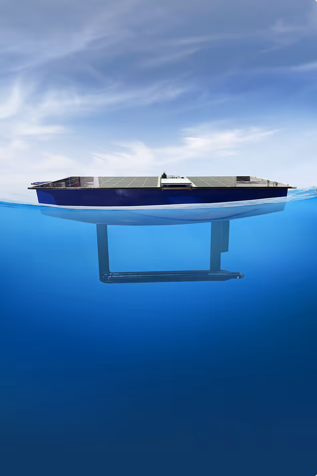
One thruster and one rudder servo. That's every moving part on the vehicle.
Unsinkable by Design
Open to the ocean by design. No trapped air, no compartment to breach, no way to sink.
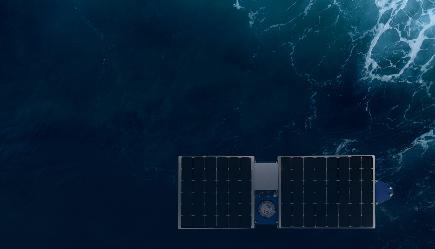
What is Spotter Scout?
Spotter Scout is an uncrewed, solar-powered vehicle that carries Spotter sensing to any ocean location and keeps it there for months. Powered by Online Oceans.
Components
Solar Array & Battery
340W solar and 2 kWh battery. Indefinite operation with no fuel or service visits.
Spotter Core
The same sensing core in every Spotter buoy. Waves, wind, and weather data to your Dashboard.
Bristlemouth Payload Bay
Add Temperature, Salinity, and other compatible sensors for co-located subsurface measurements.
Satellite/Cell Communications
Iridium for always-on telemetry. Starlink for high-bandwidth control and live video on demand.
HD Camera
Time-lapse, video, and live streaming via Starlink for situational awareness during any mission.
Magnetic-Coupled Thruster
No shaft seal to wear out. Two moving parts on the entire vessel.
Access Real-Time Water Level Data
View real-time & historical observations, set alerts, and leverage the Sofar API to ingest data into custom dashboards and applications.


Set custom thresholds on water levels and receive instant notifications.
Review data over time to identify patterns, trends, and seasonal variations.
Stream water level measurements directly into your applications with JSON-formatted data.
How Marine Professionals Use Spotter Water Level