UP TO
70%
forecast improvement
over existing models
over existing models
AVERAGE
3-5%
time, fuel,
emissions savings
emissions savings
WITHIN
0.5 kts
speed prediction
accuracy
accuracy
WITHIN
2% MT
fuel prediction
accuracy
accuracy
WAYFINDER PLATFORM
Real-Time Voyage Intelligence
Dynamic voyage planning and optimization, powered by the most accurate ocean intelligence to save time, fuel, and emissions
UP TO
50%
forecast improvement
over existing models
over existing models
AVERAGE
4-9%
fuel and
emissions savings
emissions savings
WITHIN
0.5 kts
speed prediction
accuracy for most vessels
accuracy for most vessels
WITHIN
2% MT
fuel prediction
accuracy
accuracy
The Wayfinder Platform
Plan and optimize voyages in real time to maximize fleet safety, efficiency, and profitability.
One platform, end-to-end voyage intelligence.
One platform, end-to-end voyage intelligence.
Plan
Voyage Simulation
Instantly generate and evaluate unlimited voyage scenarios using historical and real-time weather, vessel-specific models, and your custom market factors. Respond with speed and intelligence to market opportunities.
- Real-time scenario generation and editing
- Weather-aware fuel, cost, and arrival predictions
- Side-by-side economic comparisons
Execute
Voyage Optimization
Receive daily optimized RPM and route guidance, based on the most accurate ocean intelligence. Vessel-specific guidance is delivered directly to your team, ensuring you hit economic, safety, and emissions targets, even as weather and markets shift.
- Real-time route optimization
- Dynamic RPM adjustments
- Weather avoidance routing
Report
Voyage Reporting
Generate comprehensive post-voyage documentation with weather analysis and charter party tracking. Transform scattered data into structured reports that defend claims, prove savings, and support fleet decisions.
- Charter party adherence with good weather analysis
- Performance comparisons across conditions and drafts
- Documentation with verified weather data
Wayfinder Weather Advantage
Every voyage plan and optimization is powered by the world’s most accurate ocean intelligence.
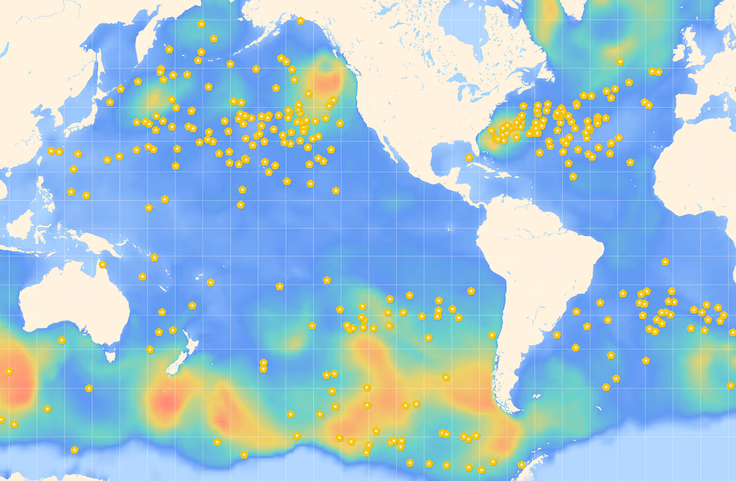
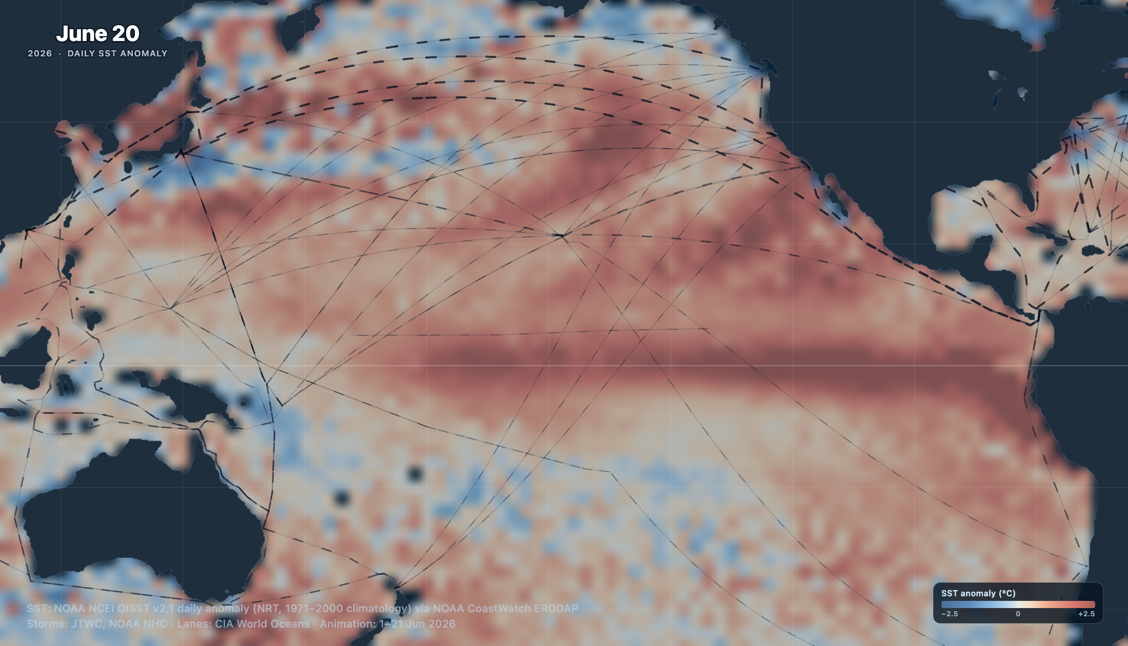
Sofar owns and operates the world’s largest private network of real-time ocean sensors, collecting millions of daily observations of waves and weather.
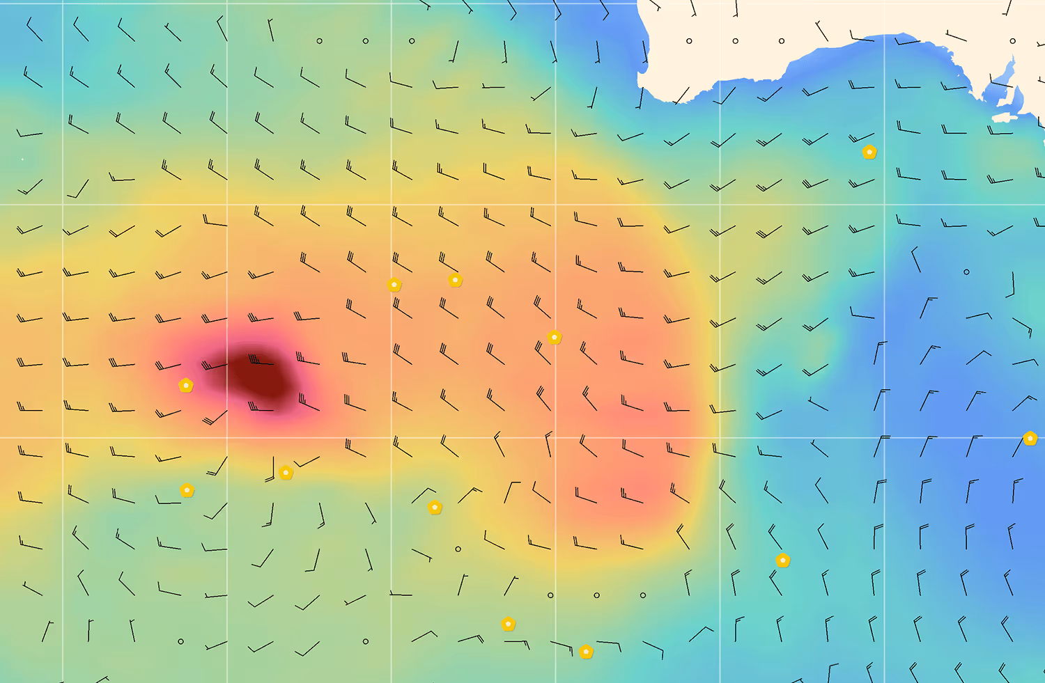
Wayfinder uses the real-time data collected by the Spotter network to produce forecasts that are up to 50% more accurate than the next best option.
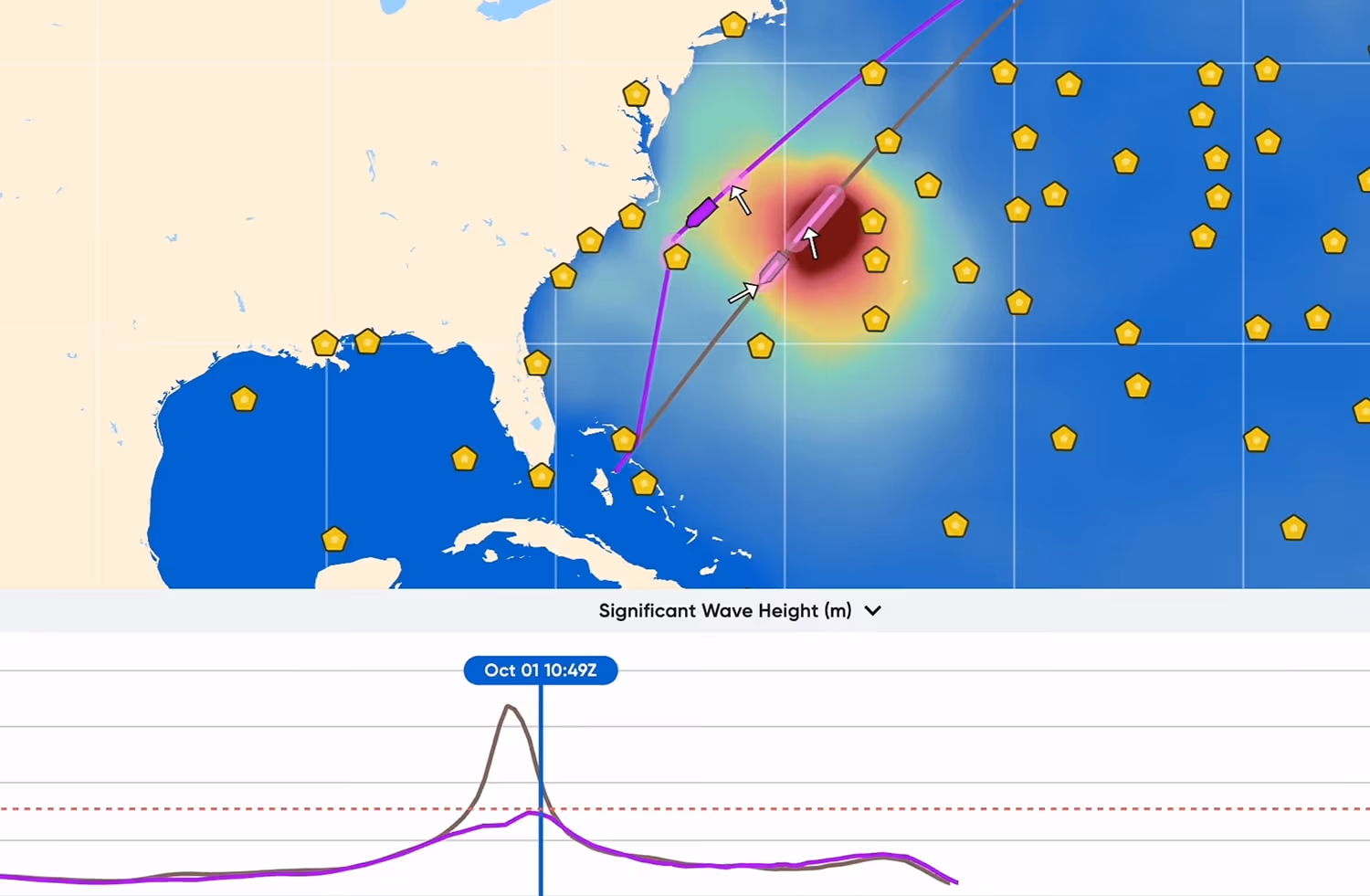
Accurate forecasts are key to precise VPM estimates. Wayfinder’s VPMs accurately predict speed and fuel in all sea states and dynamically update as weather changes.
What Our Customers Are Saying


Latest Wayfinder Updates