Track Tidal Changes & Storm Surge

Spotter Water Level

Starting at $14,985

Add a subsurface pressure sensor to your Spotter Platform to monitor water level in real time. Combine with Spotter's built-in barometer to track tidal changes, measure precise water depths, and detect storm surge.

What is the Spotter Platform?

Spotter is a modular, rapidly deployable marine sensing platform that delivers real-time surface and subsurface ocean data to power better decisions.

What is Spotter Water Level?

A turnkey solution for real-time water level monitoring. Ships globally, deploys quickly, and transmits atmospheric and subsurface pressure data instantly.
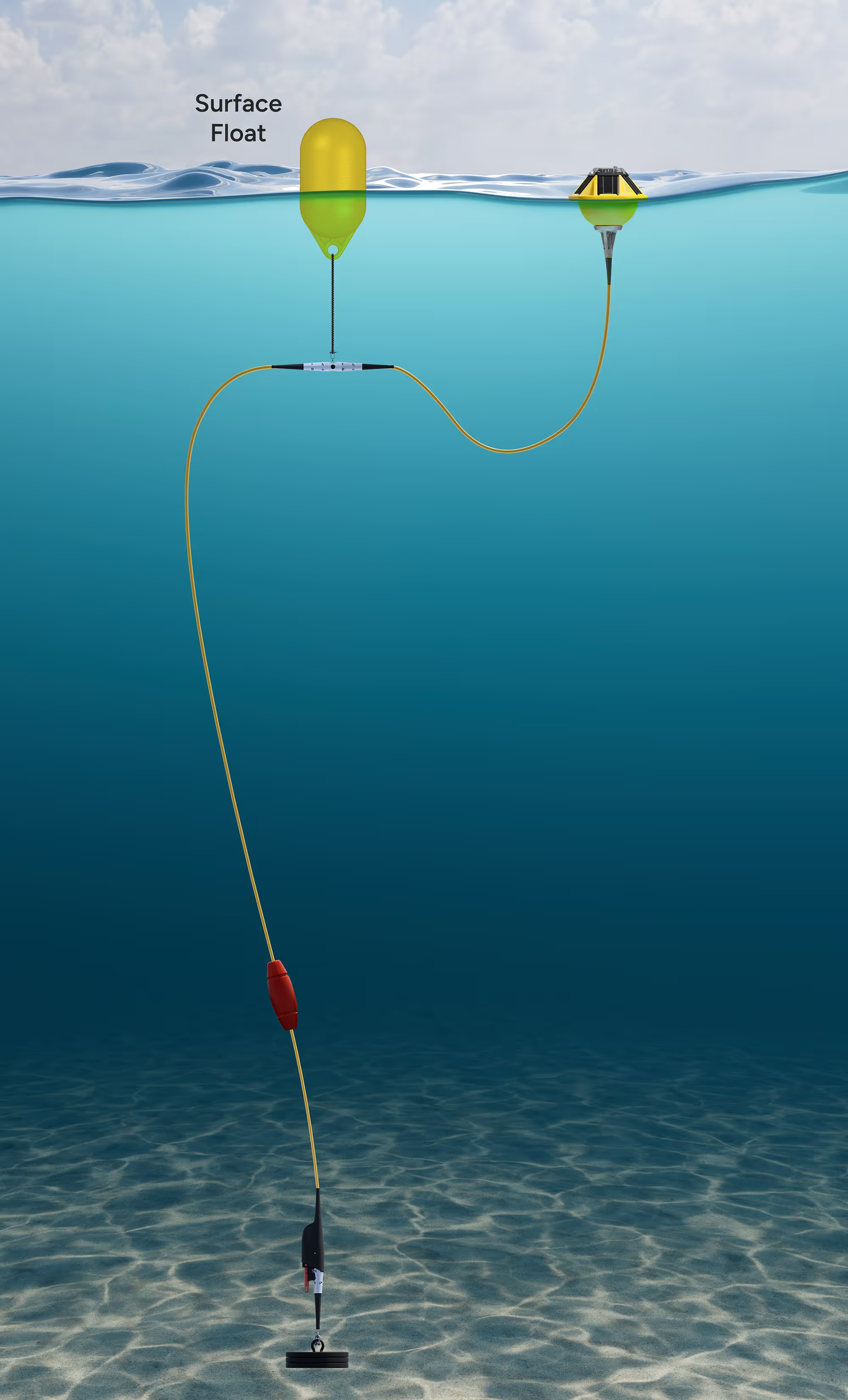
Underwater view of a yellow surface float connected by cables to an underwater device resting on the ocean floor.
Yellow buoy with solar panels on its slanted top and a metallic base.

Spotter Buoy

Hub for power and communication. Measures waves, wind, and atmospheric pressure in real time.

Coiled yellow cable with one end extending upward and a blue strap securing the coil.

Smart Mooring

Kevlar cable extending real-time data collection underwater.

Red cylindrical device labeled RBRcoda³ with a transparent circular end showing internal components.

Pressure Sensor

Measures subsurface pressure.

Slim, cylindrical device with a central metallic section featuring multiple small sensors and black tapered ends.

Add More Sensors

Enhance Spotter Water Level with additional sensors, such as:

Access Real-Time Water Level Data

View real-time & historical observations, set alerts, and leverage the Sofar API to ingest data into custom dashboards and applications.

Data dashboard for rover SPOT-0558 showing surface barometric pressure and mean subsurface pressure charts, wave spectrum, position map, wind speed and direction, significant wave height details, sea surface temperature, barometric pressure, and current sensor data dated 22 March 2025, 12:45 AM PDT.JSON data showing water pressure readings with latitude 27.9341167, longitude 34.9219667, timestamps, sensor positions, units in microbar, values, unit types as pressure, and data type names.
Real-Time Alerts
Set custom thresholds on water levels and receive instant notifications.
Historical Analysis
Review data over time to identify patterns, trends, and seasonal variations.
API Data Integration
Stream water level measurements directly into your applications with JSON-formatted data.

How Marine Professionals Use Spotter Water Level

Monitor Extreme Storms

USGS rapidly deploys Spotter Water Level to monitor hurricane-induced storm surge along the Gulf Coast.

Large ocean waves crashing under a cloudy sky.

Reduce Downtime Offshore

Spotter Water Level enables real-time monitoring of conditions near offshore assets, minimizing costly interruptions during day-to-day operations.

Offshore wind turbine standing in the sea with spinning blades against a clear sky.

Enhance Port Safety

Spotter Water Level supports dynamic assessments of port conditions to ensure safe vessel navigation and reduce the risk of groundings and collisions.

Cargo ship loaded with containers being guided by two tugboats near a container port with cranes and stacked containers.