Wayfinder Platform

Dynamic voyage optimization
in real-time

Save on fuel, time, and emission in each voyage by using the most accurate marine weather forecast and vessel performance model available.

.
+14
additional saving days
.
~9%
fuel & emissions savings
.
50%
forecast improvement over existing models
Within
0.5 kts
speed prediction accuracy for most vessels
Within
2% MT
fuel prediction accuracy

Wayfinder Core: Built different

Wayfinder is the only voyage optimization platform built on its own ocean sensor network, with forecasts built from real-time, in-the-water measurements that are 50% more accurate than competing models.

Edit routes and see the costimpact of each change immediately, with full ship- and shore-based transparency so both teams view the same data. Daily email guidance keeps routing support available regardless of connectivity.

Vessel Performance Model

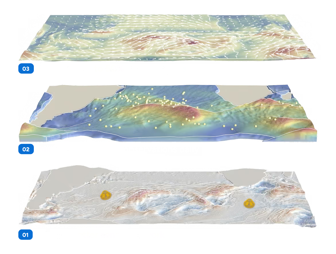
Wayfinder builds a digital twin of your vessel. It retrains on your ship's daily noon reports, so the model tracks how the vessel is actually performing throughout the voyage. Sofar’s vessel performance model predicts fuel within 2% MT and speed within 0.5 kt.

01
Naval architecture

Hull, propeller, engine design

02
Class average

Sister-ship fleet baseline

03
Your vessel's history

Past voyage performance

04
Weather

Informed by observations

05
Noon reports

Every noon

Learn more

Weather

Sofar owns and operates the world's largest private network of ocean sensors , feeding millions of real-time observations into forecasts every day. These observations build directly into our forecast which is up to 50 percent more accurate than other leading models.

Learn more

Voyage Simulator

Only Wayfinder lets you change route geometry and engine settings on any segment of a route, re-simulating against live weather and the digital twin after every edit and quantifying the cost, time, and fuel impact of every decision. No other platform does this.

Alerts

Wayfinder tells you when a vessel goes off track, rejects a route, is heading into a tropical storm, high wind, or high waves. Users choose the vessels, alert types, and thresholds.

Collaboration

Users can send a route, or a set of route options, by link to any other Wayfinder user. The recipient can view, compare, and activate routes for optimal transparency across teams.

View and Audit

See realized savings per voyage, per vessel, and across the fleet, with fuel and time gains attributed to the routes actually taken. At the end of every voyage, Wayfinder measures achieved speed and consumption against the terms of your charter party.

Built for how you operate

Guidance

Route with a team of former captains, oceanographers, and meteorologists behind every voyage. Sofar Ocean's routing team reviews the full voyage, from safety and efficiency to schedule pressure and regional disruptions, and delivers optimized guidance to your bridge every day.

Optimize add on
24/7 expert routing & meteorological team
Daily optimized speed & route guidance
Wayfinder core (included in both)
VPM (Digital Twin)
Weather
Fleet Dashboard
Alerts

Example email providing guidance from Sofar's routing team.

Wayfinder dashboard featuring the intelligent “Optimize” button that will automatically select the best route for your team.

Explore

Self-service puts voyage optimization in your team's hands. With one click, captains and shoreside can generate a route that maximizes efficiency while meeting your required arrival time, and share it between ship and shore.

Explore add on
One click RTA with Fuel Minimization NEW
On demand expert routing & meteorological assistance NEW
Sharing/pushing routes from user to user NEW
Results in minutes, locally run and available offline.
Waypoint Editing NEW
View & Audit Snapshots of route decision making NEW
Wayfinder Platform (included in both)
VPM (Digital Twin)
Weather
Fleet Dashboard
Alerts

Wayfinder vs. the competition

Capability
Weather
Wave measurement
Vessel performance models
Voyage optimization
Voyage simulator
Rapid onboarding
Proof of savings
Waypoint editing
Wayfinder Dynamic
Largest private network of real-time ocean sensors
Global ocean coverage
Each ship's own model recalibrated daily
Optimization via Sofar’s open-ocean wave forecasts
Test against live weather and your ship’s digital twin
Onboard within hours with no hardware or installation
6.9% fleet-wide average
Adjust RPM to understand cost, time, and fuel impacts.
Typical Voyage Opt.
Third-party satellite
data
Limited coverage
Hull model library, calibrated on third-party weather
Route optimized at fixed power
 Not available
Onboard sensors for some modules
No published fleet average
Not included
Typical Weather Routing
Third-party global
models
Limited coverage
Mainly based on
vessel type
Route optimized at constant power
 Not available
Onboard software installation
1 to 3%
Not included

Wayfinder for every charter position

Every charter structure changes what you control and what you're still accountable for.

Owner-operated

Optimization only works if the ship accepts guidance. You control the routing. The open question is whether the bridge agrees with the plan.

  • Shore and bridge run on the same data, so a route disagreement is a real one.
  • Captains edit waypoints and speed, optimize the change, lock what they want held.
  • RPM adherence and routing acceptance tracked per vessel, visible from shore.
  • Speed within 0.5 knots, fuel within 2% MT, recalibrated daily on Sofar's own forecasts.

Chartered-in

Onboard a chartered vessel in under an hour. Short fixtures don't leave room for a calibration period.

  • An IMO number is the whole setup. Particulars pulled, limits confirmed, noon reports flowing.
  • A class-average model optimizes from day one, then tunes with every noon report.
  • Voyage Simulator prices the fixture against charter party terms, arrival time, and fuel cost before you commit.

Chartered-out

See the ships you don't route. Someone else controls the routing. The performance risk and the claims are still yours.

  • Performance modeling, tracking, weather, and safety alerts on third-party-routed tonnage.
  • Claims evidence inside 48 hours, with the speed and fuel curves behind it.
  • Seakeeping alerting runs on every vessel on the platform.
  • Missing and anomalous data flags itself, while there's still time to fix it.

Mixed fleets

Coverage everywhere, optimization where it counts. Most fleets are all three at once.

  • Owned and chartered tonnage in one configurable view.
  • Full optimization where you route, monitoring where you don't.
  • Seakeeping alerts and Sofar weather on every vessel, whatever the tier.
  • Every hull modeled and calibrated daily, which is what makes fleet-wide comparison possible.
Trusted By

What our customers are saying

"We are pleased to renew our relationship with Sofar Ocean...Wayfinder helps us to plan our voyages and route our ships more effectively."

Stefan Tashchiev
Stefan Tashchiev, Director of Operations at Koch Shipping

“As we continue to grow the fleet, we are investing in operational efficiency, digital development, and more energy-efficient operations across the business. We reviewed and trialled the available options thoroughly. Wayfinder stood out for its ability to improve our weather visibility, enhance route and speed decisions, and strengthen execution between our ship and shore teams.”

Per Ekmann
Per Ekmann, CEO, Uni-Tankers

"We expect that Wayfinder, which utilizes cutting-edge technologies such as Sofar’s global network of ocean sensors and data-driven Vessel Performance Models, will greatly contribute to the efficient operation of MOL Group’s Fleet."

Ryusuke Kimura
Chief Digital & Information Officer, MOL Group

"Wayfinder allows us to increase vessel utilization and efficiency, ensuring that we balance profitability with emissions reduction objectives. By using Wayfinder's data and voyage optimization, we've seen efficiency gains in the range of 4.5% on dedicated voyages, which translates into as many as 14 additional sailing days per year per vessel.”

James Marshall
CEO, Berge Bulk

“Wayfinder gives our Masters practical, data-driven guidance for route and speed decisions while helping our shore teams maintain visibility into vessel performance and voyage risk. Before choosing Wayfinder we evaluated the available options for voyage optimization and weather guidance. Through our work with Sofar Ocean we have seen how high-precision weather data, vessel performance models, and daily optimization guidance support safer, more efficient operations as well as better informed conversations with charterers.”

Capt. Tomoaki Nakanishi
Capt. Tomoaki Nakanishi, Group Manager, NYK Tankers