Sofar Data Services provide access to the largest planetary scale ocean data network, which includes:
The Sofar team always strives to augment these ocean data offerings and is excited to share two improvements to the Sofar Marine Weather API. Let’s dive into the details.
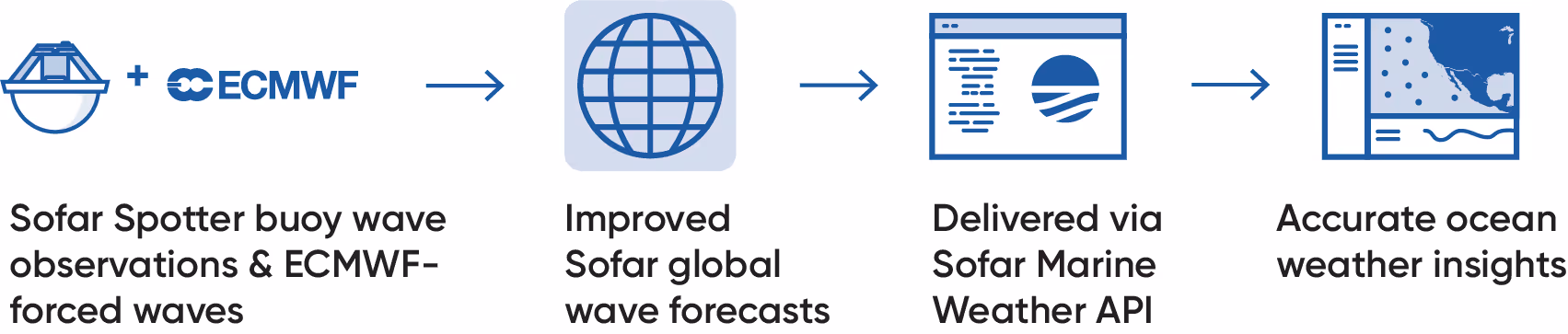
Sofar’s global wave forecasting system now uses wind data from the European Centre for Medium-Range Weather Forecasts (ECMWF) — recognized as the world leader in global forecasting — to produce wave predictions. This is a foundational upgrade that increases the accuracy of Sofar’s ocean weather forecasts. Generally, using ECMWF winds instead of National Oceanic and Atmospheric Administration (NOAA) Global Forecast System (GFS) winds has led to improvements in Sofar’s wave forecast skill of greater than 20%. An ECMWF-forced waves endpoint is now available on the Marine Weather API.
The ECMWF-forced waves endpoint is complemented by real-time ocean observations collected by the global Spotter buoy network, which are used to initialize forecasts and have lasting effects throughout the forecast horizon. Figure 1 demonstrates how ECMWF-forced waves and buoy observations are operationalized.
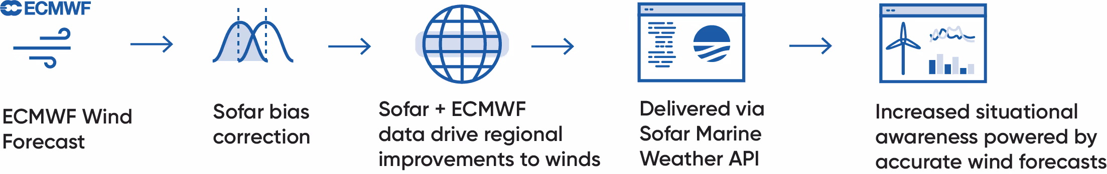
The Marine Weather API now also includes an endpoint for Sofar’s bias-corrected ECMWF winds. This new ECMWF+Sofar winds endpoint applies a statistical correction that improves accuracy in surface winds by removing consistently appearing errors in the ECMWF forecasts. So far, results have shown overall improvements in wind forecasts at lead times up to three days in the Tropics (+/- 23º N/S), the Gulf of Mexico, and the Indian Ocean, success that the Sofar team looks forward to building upon. Figure 2 visualizes how this endpoint is produced and operationalized.
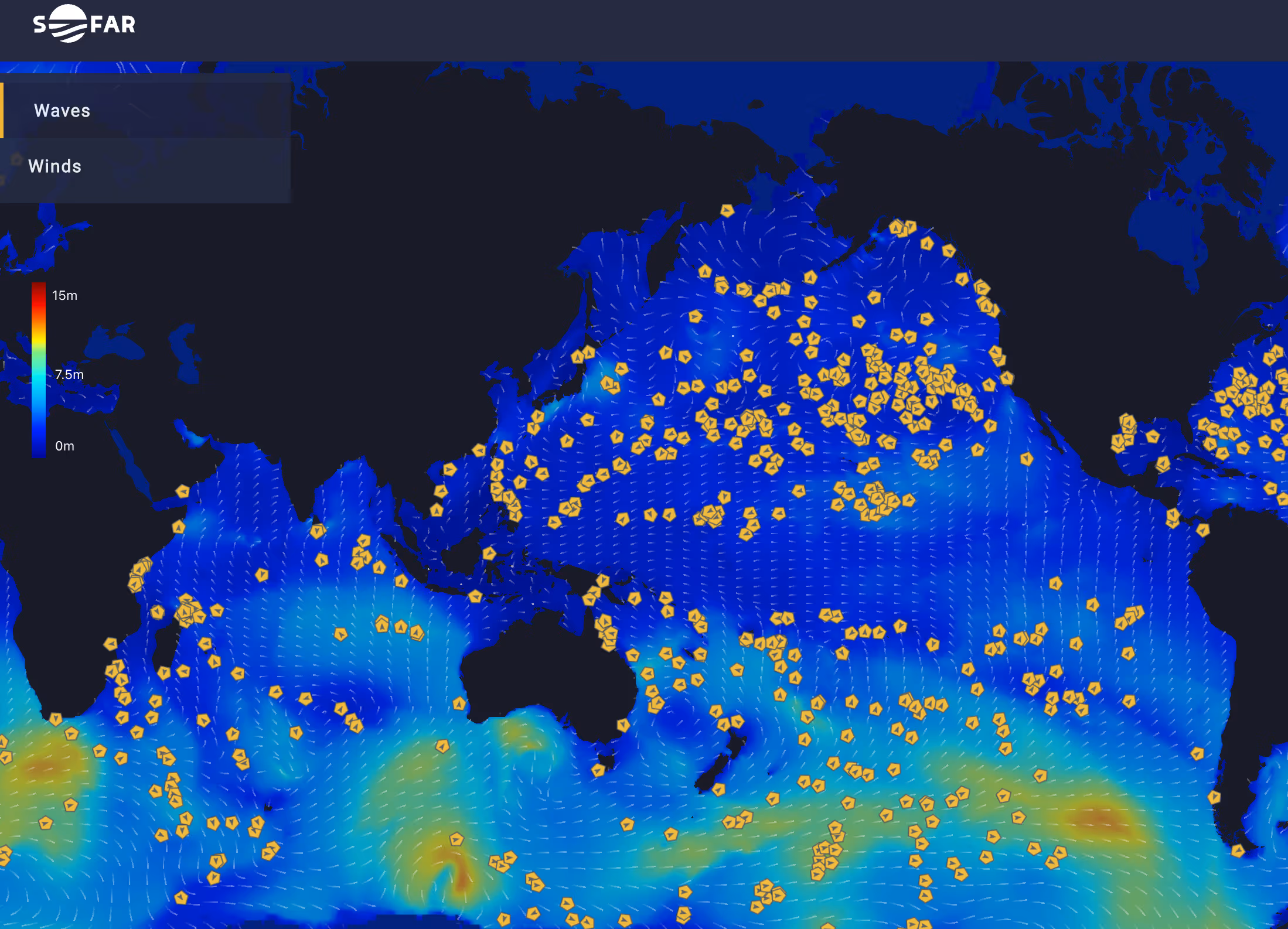
A common use case of the Marine Weather API is the incorporation of weather data into a Common Operational Picture (COP). A COP displays all relevant operational information for a project, mission, etc. and informs planning and decision making.
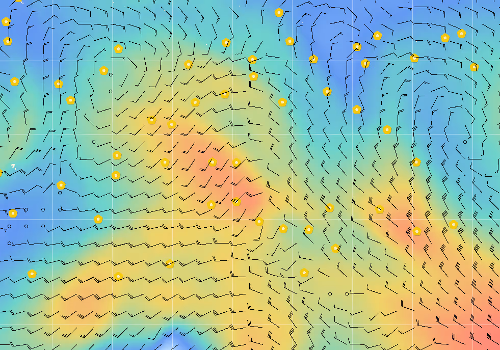
In Figure 3, a sample COP built in the Esri platform displays active offshore pipelines (black lines), Spotter buoy drift tracks (yellow lines) and, using the Marine Weather API, Sofar’s global wave forecast colored by significant wave height. COPs like this increase situational awareness for blue economy stakeholders operating in the Gulf of Mexico to support safety & risk assessment, environmental monitoring, and site characterization.

To learn more, visit the Data Services page or schedule a Data Services demo.