This blog was written by Dr. Graziela Miot da Silva of Flinders University.
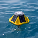
On August 13th 2021, a team of researchers from Flinders University and the South Australian Research and Development Institute (SARDI) deployed two Spotter wave buoys in Gulf Saint Vincent, South Australia (SA), via a collaboration between Flinders University, SARDI, SA Water, the SA Environmental Protection Agency (EPA), supported by the Integrated Marine Observing System (IMOS) and funded by the SA Department of Environment and Water (DEW). Two buoys were launched off Semaphore Beach and Brighton Beach in August, with a third buoy deployed in Investigator Strait in September to capture the largest waves that enter the gulf from the Southern Ocean. This project will create the first network of wave observations in Gulf Saint Vincent, providing long-term monitoring with real-time data for the Adelaide Metropolitan Coast, and a novel understanding of the wave climate in the Gulf. Measurements collected by the Spotters will help build a better coastal community by:
• improving understanding of hydrodynamic processes that shape SA coastlines
• informing coastal management best practices
• driving the development of marine industries
• promoting and supporting tourism

Adelaide is the fifth-largest Australian city and sits on the eastern side of Gulf Saint Vincent. The Adelaide Metropolitan Coast and its sandy beaches have been artificially maintained by sand nourishment programs since the 1970s by the State Government. The area has ongoing issues with coastal erosion due to northwards wave-driven sand movement, exacerbated by historical seagrass loss, that has increased sediment accumulation in the northern beaches and loss along the central and southern parts of the coast.
The South Australian open coast faces some of the largest swells in the world produced in the Southern Ocean. Gulf Saint Vincent, however, does not often receive these swells due to the protection offered by Kangaroo Island. Waves in Gulf Saint Vincent are generally low (<0.5 meters on average), however, occasional SSW swells enter the Gulf through Investigator Strait (between Kangaroo Island and the Yorke Peninsula), enhancing the northwards sediment transport and causing damage to coastal infrastructure.
The provision of accurate wave data is critical to improve our understanding of variations in the hydrodynamic processes that shape our coastlines, to inform best coastal management practices, drive the development of marine industries, and to promote and support tourism. To date, there has been a significant gap in the wave information available to researchers, managers, developers and policy makers that is needed to guide the sustainable management of the regional and metropolitan coastlines of Gulf Saint Vincent. This project addresses the lack of hydrodynamic data in Gulf Saint Vincent and adds value to collaborative initiatives that will benefit coastal management initiatives such as sediment nourishment practices to maintain the Adelaide metropolitan beaches.
The real-time wave data collected by this project will allow for the development of validated data-assimilating wave models with the capability to be coupled with existing hydrodynamic (SARDI, SA water), sediment transport (SA Water, Flinders) and biogeochemical (SARDI, SA Water) models for the Gulf. In addition, access to real-time wave data will provide valuable information necessary for informing daily marine operations, such as dredging, navigation, and sea conditions for commercial and recreational fishermen, and search and rescue, and water-based research and monitoring programs, thus providing value to a range of stakeholders across the community.


.avif)