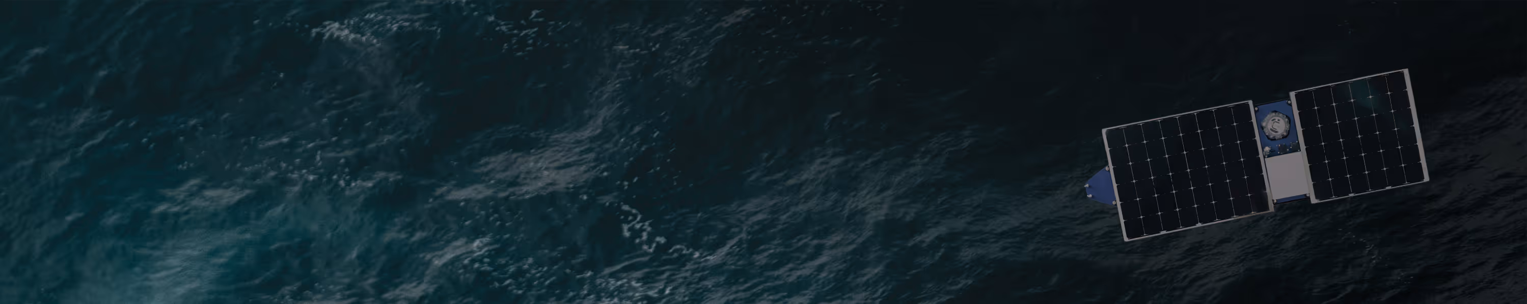
Spotter Scout
Starting at $69,995
Trusted Spotter wave, weather, and ocean sensing on a long-endurance uncrewed vehicle built by Online Oceans. Station-keep in deep water for months, transit between locations, or deploy as a drifter that returns home.
Spotter is a modular, rapidly deployable marine sensing platform that delivers real-time surface and subsurface ocean data to power better decisions.
Engineered to Endure
The ocean is hard on everything you put into it. Spotter Scout is engineered to take the punishment and keep operating unattended for months at a time.
Storm Proven
Survivable. Self-righting in any conditions. Operational through Sea State 7–8.
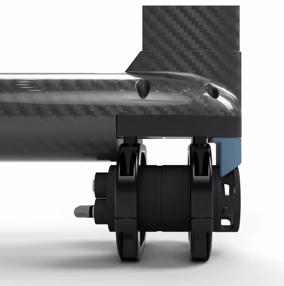
Radically Simple
One thruster and one rudder servo. That's every moving part on the vehicle.
Resilient by Design
Open to the ocean by design. No trapped air, no compartment to breach, nothing to flood.
What is
Spotter Scout?
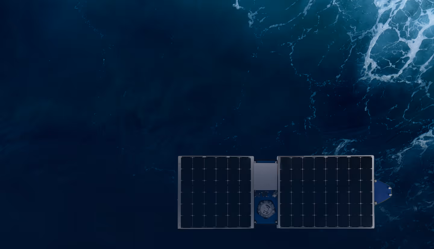
Spotter Scout is an uncrewed, solar-powered vehicle built by Online Oceans. It carries Sofar's trusted Spotter sensing to any ocean location and keeps it there for months.

Solar Array & Battery
340W solar and 2 kWh battery. Months of operation with no fuel required.
Spotter Core
The same sensing core in every Spotter buoy. Waves, wind, and weather data to your Dashboard.
Bristlemouth Payload Bay
Add Temperature, Salinity, and other compatible sensors for co-located subsurface measurements.

Satellite/Cell Communications
Iridium for always-on telemetry. Starlink for high-bandwidth control and live video on demand.

HD Camera
Time-lapse, video, and live streaming via Starlink for situational awareness during any mission.
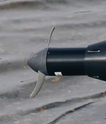
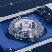
Magnetic-Coupled Thruster
No shaft seal to wear out. Two moving parts on the entire vessel.
Mission Modes
Four ways to deploy Spotter Scout, from holding position in deep water to surveying entire regions with a single asset.
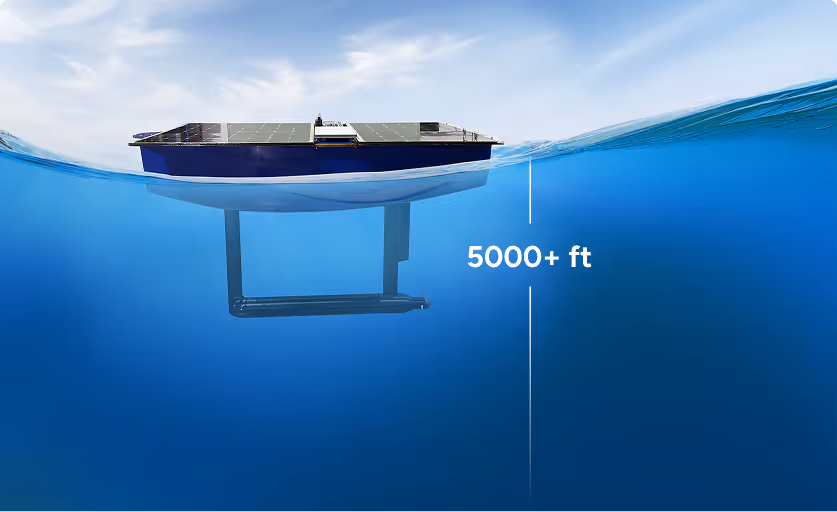
Deep Water Station Keeping
Hold position offshore without a mooring. Configure your station-keeping radius from 50m to 10km and maintain presence for months.
Offshore Wind Site Characterization
Deep Water Metocean Monitoring
Pre-Installation Site Surveys
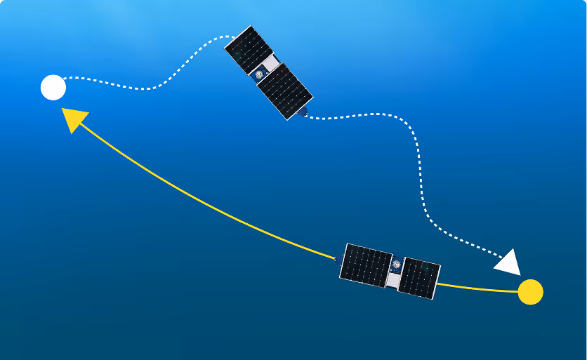
Return-to-Home Drifting
Deploy as a drifter to follow currents and collect data along the way. When the mission is complete, command it to return. No retrieval vessel required.
Lagrangian Current Studies
Search and Rescue Support
Oil Spill Tracking
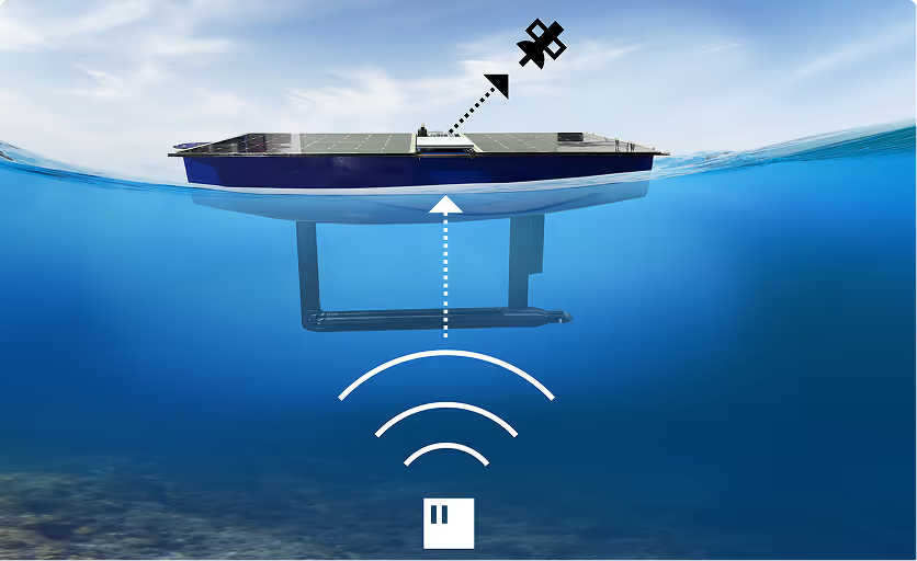
Subsea-to-Satellite Gateway
Relay data from seabed sensors to the cloud without fixed infrastructure. Receive acoustic transmissions and forward via satellite, bridging seafloor to dashboard.
Seabed Environmental Monitoring
Offshore Wind Foundation Monitoring
Remote Pipeline Observation
Spatial Survey & Gap Filling
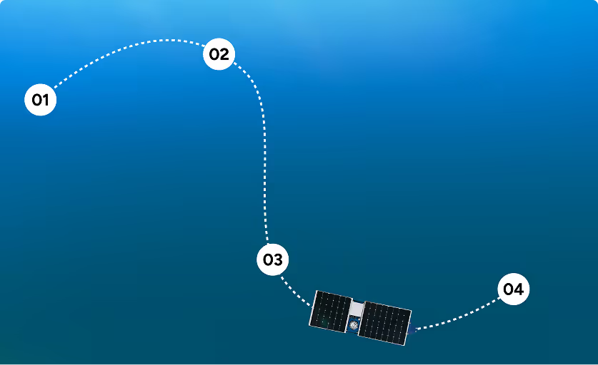
Transit between locations to measure how conditions vary across a region. Fill coverage gaps in your Spotter network or scout new deployment sites.
Regional Metocean Surveys
Marine Protected Area Monitoring
Site Scouting
See Spotter Scout in Action
Watch Spotter Scout deploy, transit, and hold station in open ocean.
Command the Vehicle. Access the Data.
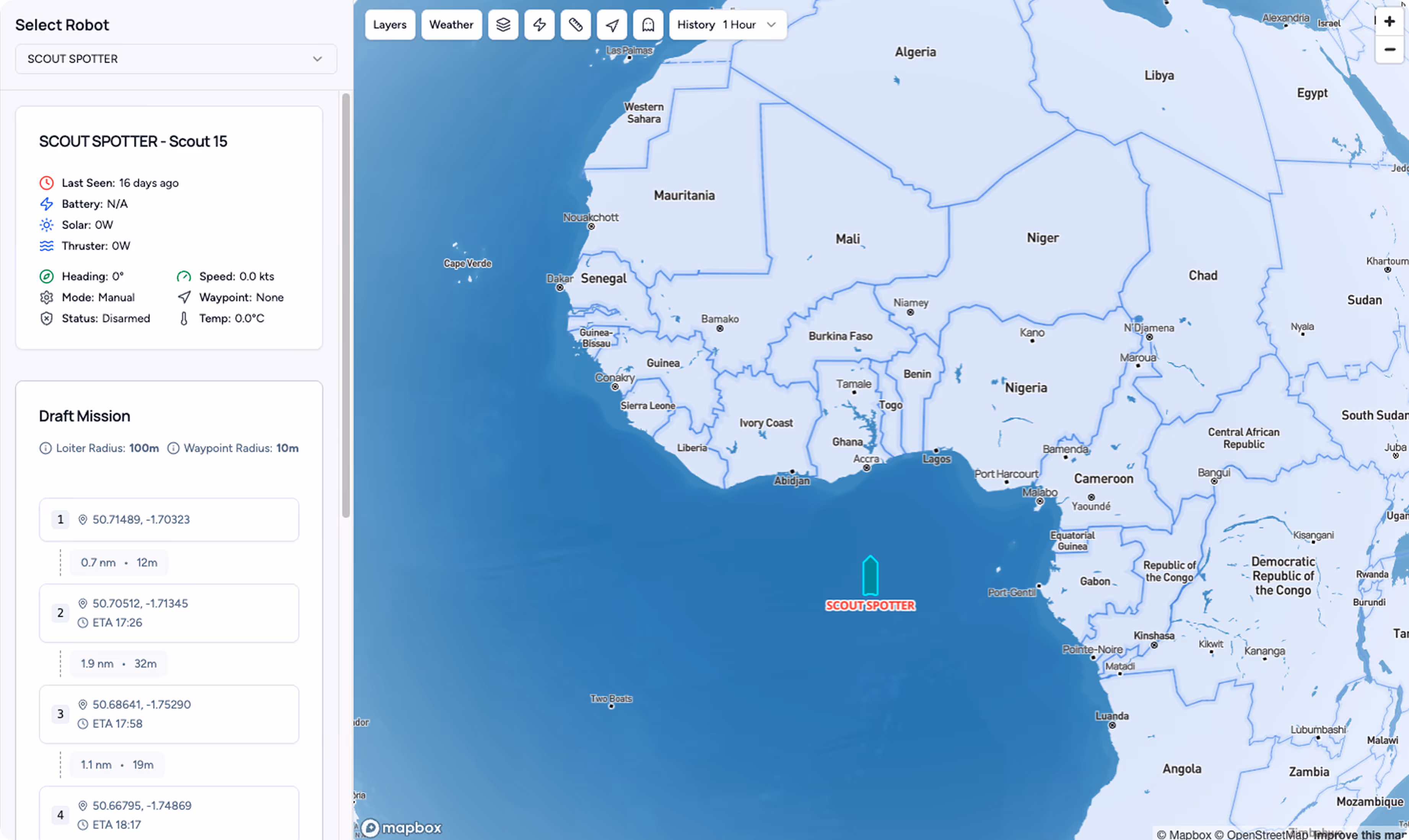
Two platforms, one workflow. Tether controls where your Spotter Scout goes. The Spotter Dashboard shows what it measures.
Set waypoints, configure station-keeping, and monitor navigation from any device.
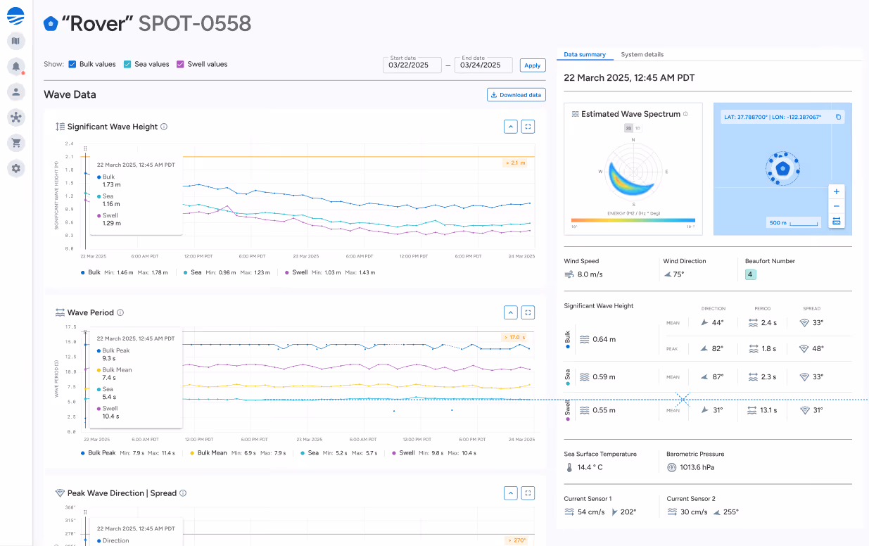
Wave spectra, weather, and subsurface observations streaming to the Spotter Dashboard.
Stream ocean observations directly into your applications with JSON-formatted data via the Spotter API.

Core Specifications
Key specifications at a glance.
View the full spec sheet for complete details.