
Saipan is four miles wide and twelve miles long, and for the people who manage its coast, the most consequential stretches sit on the island's leeward west side. Those wave-shadowed beaches have been eroding for years. Sediment moves in ways that clog navigation channels and undercut infrastructure at Garapan, the island's main tourism district and a National Park Service property. At one reef pass the pattern is more immediate: when waves climb past about two meters, swimmers and fishermen get pulled into the channel, and someone has to go out and bring them back, nearly every year.
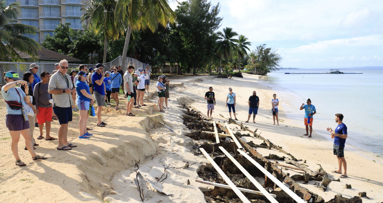
For more than a decade, resource managers, researchers, and coral restoration practitioners had talked through natural ways to defend and stabilize those shorelines. They kept hitting the same wall: watching coastal decisions and hazard plans take shape without the evidence to support them. The one publicly available wave buoy, a large Datawell Waverider several miles offshore, did not reflect what the leeward beaches were experiencing. The central question stayed open. How was strong east-northeast trade swell driving sediment off the west-facing beaches?
Robbie Greene, Associate Director at Pacific Coastal Research & Planning (PCRP), had spent years keeping that offshore Waverider running. It was heavy, demanding equipment for a small team, and it answered the wrong question anyway, telling them about deep water several miles out when the problems were unfolding in the surf zone.
What changed things was less a procurement decision than a fit. PCRP's introduction to Sofar Ocean came through PacIOOS, the University of Hawaii-based observing system that PCRP serves as, in Greene's words, "the eyes, ears and hands in the water" across the Northern Marianas. PacIOOS was rolling out the Backyard Buoys program, an NSF-funded effort to put modern ocean sensing in the hands of small communities that lack the capacity to run large instruments. Spotter was the piece that made the model work.
A Spotter is small enough to deploy without a specialized vessel or a crane, and it sends data in real time over satellite or cellular into one dashboard. For a small island team, that combination was the whole point. It meant the Spotters could go exactly where needed, not just the handful of sites that warranted mobilizing a vessel and crew. It meant the community could manage the full lifecycle, from siting to deployment to the data itself. And the economics of the platform meant a place like Saipan could put real instruments in the water and treat the network as its own, rather than waiting for outside experts to arrive, collect, and leave.
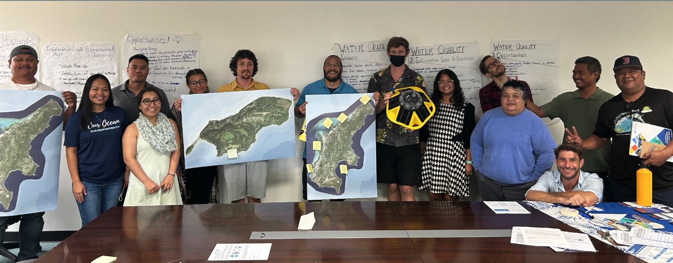
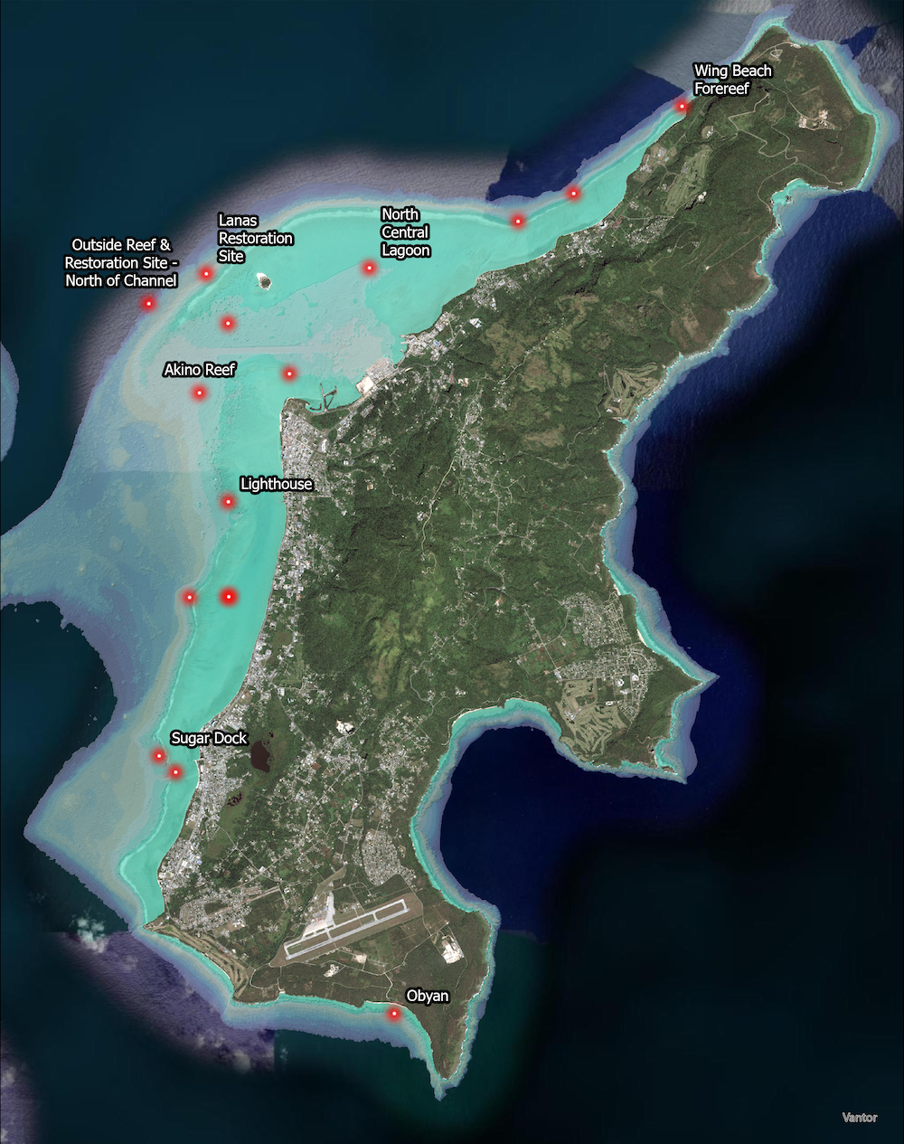
It started with a workshop. In 2022, PCRP and PacIOOS gathered local agencies, NGOs, researchers, and community members to build a wish list of the ocean observing the islands actually wanted. Community-stewarded buoys, sited where local issues lived, rose to the top of that list. From there the team ran a months-long participatory siting process, using an interactive web map to collect input from resource managers, coral ecologists, restoration practitioners, fishing clubs, and people who simply love a particular beach and hate to watch it erode. Much of the real work, Greene noted, happened the way it usually does on Saipan: standing on the beach, talking through the problem. Two sites off the west coast emerged as clear winners, each answering several local questions at once, from coastal hazards to fishing and recreation safety to the shoreline change near Garapan.
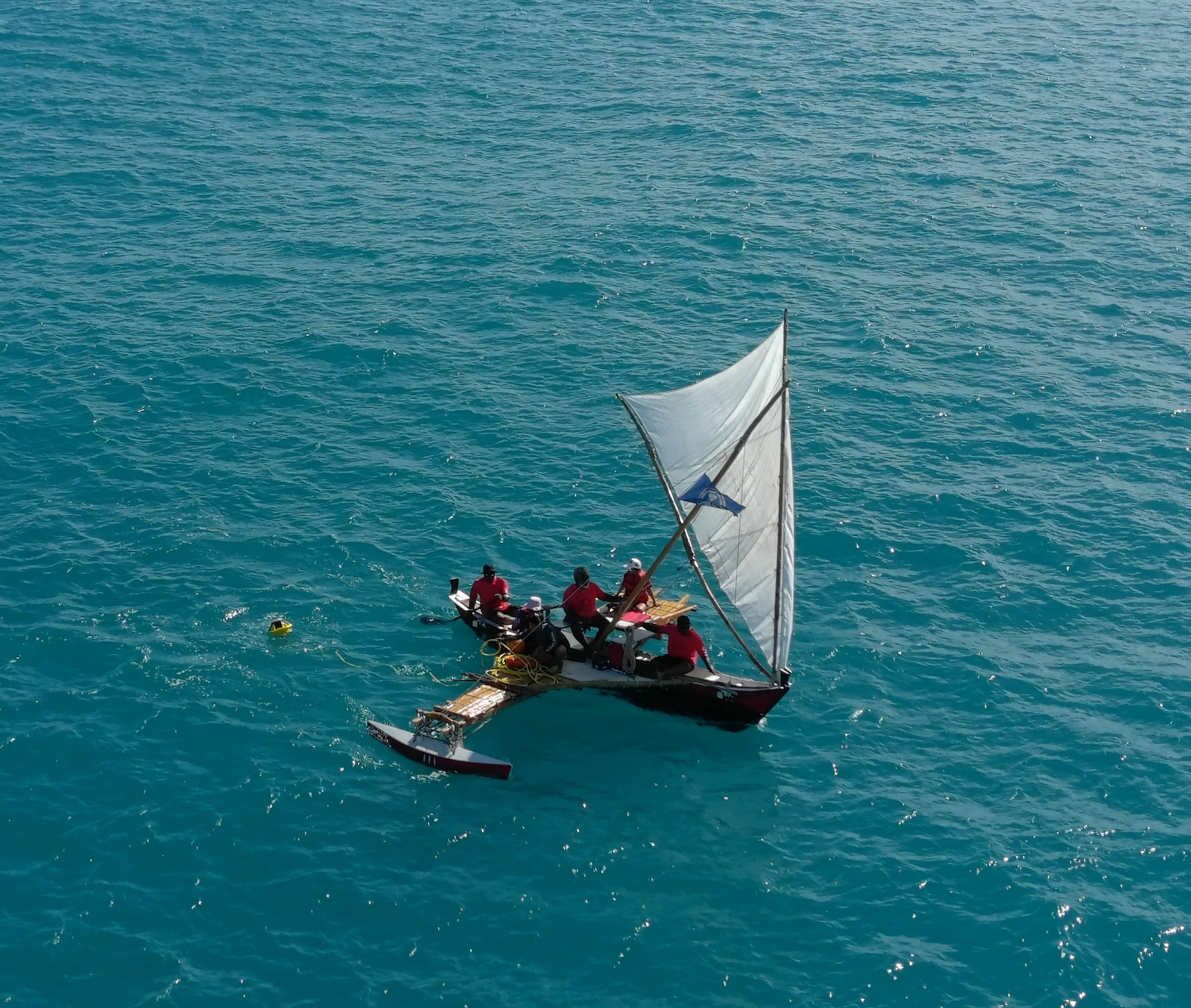
Then came the part that drew the island in. For deployment, PCRP partnered with 500 Sails, a Saipan-based organization reviving traditional Chamorro and Carolinian voyaging. The Spotters were nearshore and manageable, and 500 Sails offered to put them in the water the way passages have been made here for generations. In January and February 2026, their master navigators deployed the Spotters from traditional sailing canoes, no motors and no charts. The deployments made the local press, and the visibility mattered: the whole community knew whose Spotters these were.
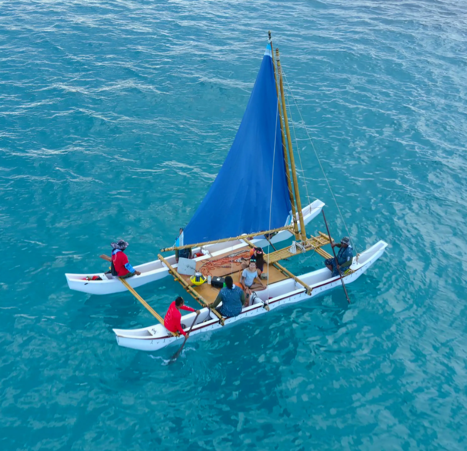
The moorings themselves were built on island. PCRP fabricated pyramid anchors from materials on hand and designed the moorings for more than the Spotter alone, because local fishermen had a warning. During the seasonal runs of atulai, the bigeye scad, boats would tie off to the surface floats. The team needed to "design those buoys to hold more than just a buoy." That kind of local knowledge, built straight into the hardware, is exactly what the model is meant to capture.
In mid-April 2026, less than three months after the canoes went out, Super Typhoon Sinlaku passed directly over Saipan and Tinian as a Category 4. It was enormous, with tropical-storm-force winds extending well over a hundred miles, and it arrived after a late northward track shift. PCRP's storm protocol was to swap each Spotter for a dummy buoy ahead of a direct hit, but Sinlaku's wind field grew too wide too quickly. By the time the track turned toward Saipan, it was no longer safe to get on the water. The team left the Spotters in place and hoped.
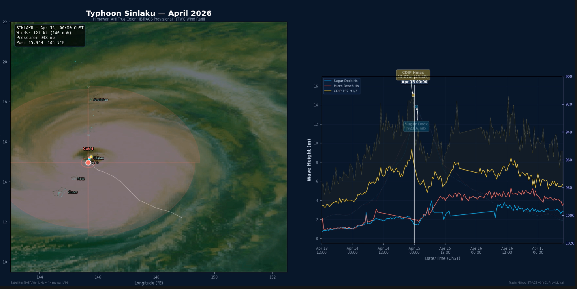
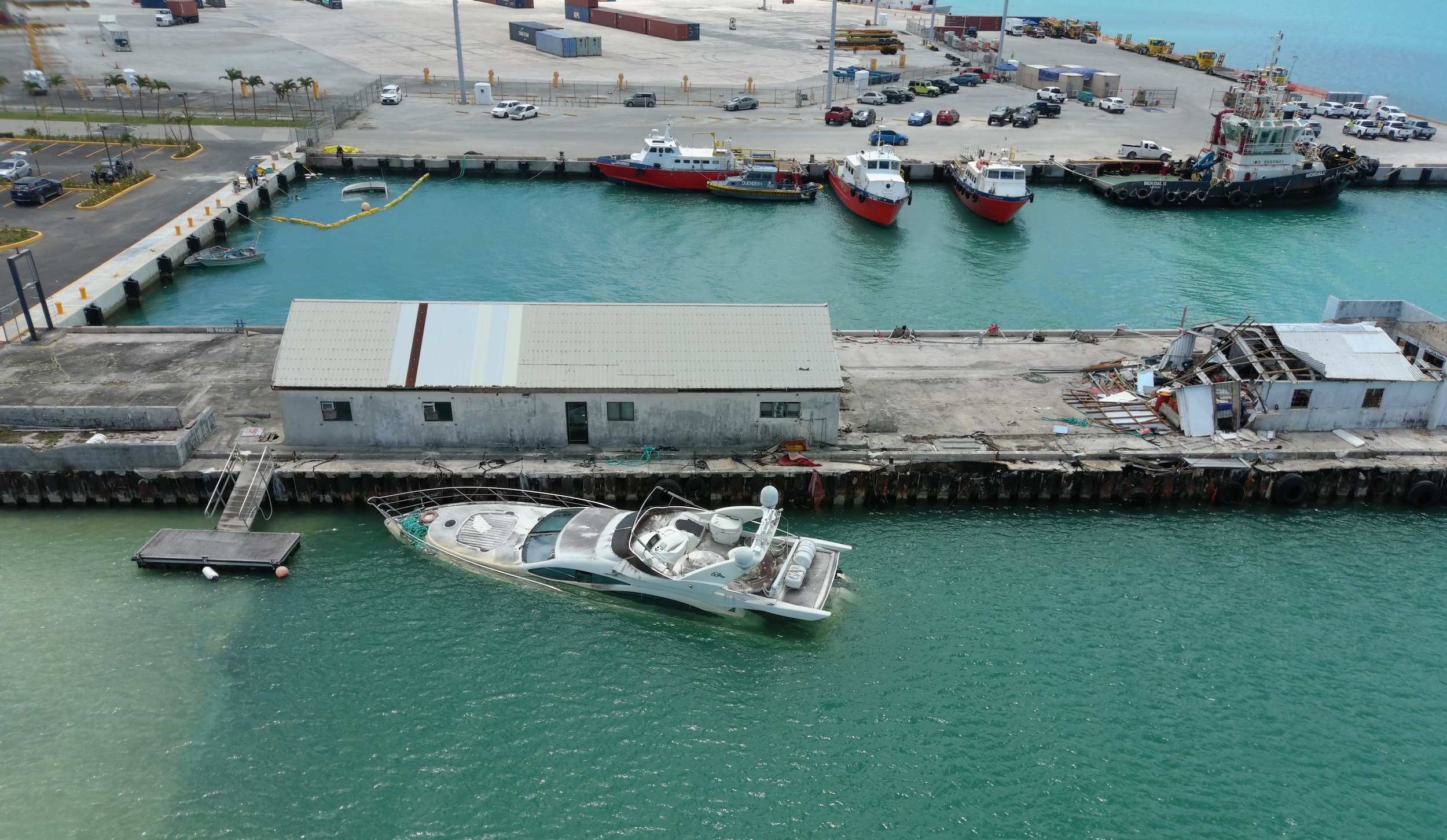
Saipan sat under a typhoon warning for four and a half days, reportedly the longest-duration extreme wind warning on record in the United States. Greene would not get power back at home for 62 days. Across both islands, instrument after instrument failed. At the port, a commercial vessel tore loose and destroyed the tide gauge. The two Spotters kept transmitting. Anchored in roughly nine to twelve meters of water just off the reef, they were pulled under repeatedly as the eye crossed, going quiet at staggered times, so that together they held a continuous record straight through the storm. They were among the only scientific instruments on either island still reporting as the eye passed overhead.
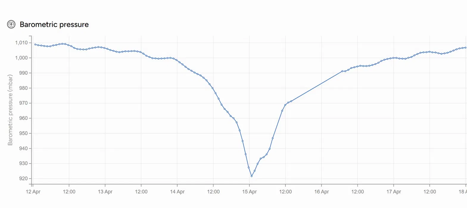
What the Spotters captured turned out to be the part nobody expected to matter so much. As the eye crossed in the early hours of April 15, the two Spotters recorded the storm's pressure where almost nothing else could: a low of 921.6 mb at Sugar Dock and 926.7 mb at Micro Beach. Satellite-derived estimates had put the storm's central pressure near 933 mb. The Spotter readings gave the National Weather Service a hard, local ground-truth, and the agency has folded them into its post-storm reporting. In the briefing NWS delivered to the governors of Guam and the CNMI, the sea-level-pressure slide showed exactly three sources: one weather station and the two community Spotters.
The storm left one more piece of evidence behind. The Spotter off Micro Beach dragged almost 600 feet as the first eyewall drove in from the northeast. When the southern eyewall arrived and the winds clocked around, it dragged back to nearly the exact spot where it had been anchored. Greene credits a good anchor and, honestly, good luck. The experience reset the team's whole posture toward extreme events. "Seeing the Spotters' performance in Sinlaku, we are way more confident now in leaving the buoys in-place to capture future extreme events," he says.
Sinlaku also delivered an unexpected answer to the decade-old shoreline question. For years PCRP had suspected that strong southwesterly surges, largely absent the past five years, were what pushed sand back over the reef and into the lagoon. The storm's southern eyewall produced exactly those conditions, and the Spotter data lined up with what the team saw on the beaches afterward. So much sediment moved that the storm acted as a one-time nourishment event, restoring some beaches to something close to their state 15 years ago. The data did not just survive the storm. It confirmed a working theory the island had never been able to test.
Ask Greene about the return on the investment and he goes straight past the dollars. In small, remote Pacific islands, he says, there is real value in a community feeling genuine ownership of its own instruments and observations. "It's quite the departure from the usual scene of 'outside experts' visiting the island to deploy or manage equipment." It is one of the first times the CNMI has stewarded ocean observing end to end, and he is convinced the community visibility is part of why the Spotters are still in the water and unbothered.
PCRP's near-term focus is the question that started all of this. The Micro Beach Spotter will feed a full hydrodynamic and sediment-transport modeling effort, run with coastal engineers and coral restoration practitioners, to design nature-based and hybrid reef approaches for stabilizing one of the most valued beaches in the Marianas. A Stanford coastal-engineering graduate, originally from Saipan, is helping lead the modeling, with the Spotter supplying the wave input at the edge of the study area. The Spotters are staying put for at least two years to capture full seasonality, and interest in the model is already spreading to other communities across the Pacific.
I'd liken the feeling to a household pivoting from being on a massive electrical grid, tied to a power plant that they can't really manage, to deploying a small, scalable solar solution or micro-grid. - Robbie Greene, Associate Director, Pacific Coastal Research & Planning
Learn more about Pacific Coastal Research & Planning and the Spotter platform.


