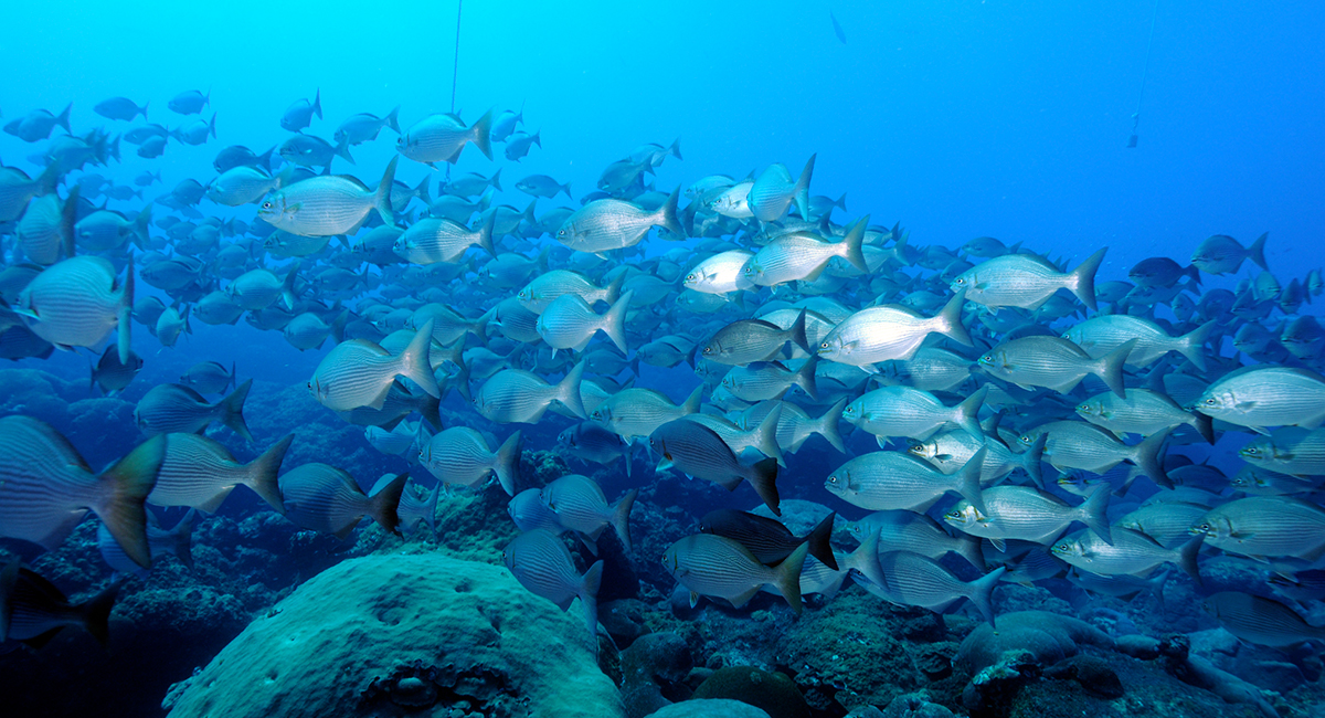
The Flower Garden Banks National Marine Sanctuary sits roughly 100 nautical miles off the coast of Galveston, Texas, on the outer continental shelf of the Gulf of Mexico. It is the only coral reef system in the northern Gulf, and among the northernmost reefs in the western Atlantic. Unlike the shallow, sprawling reefs of the Florida Keys or the Caribbean, the Flower Garden Banks are "bank reefs," coral communities perched atop salt dome formations where the reef crest doesn't begin until about 20 meters down and extends much deeper from there.
That depth matters. Satellite-derived sea surface temperature products, which typically resolve in five-kilometer grids, cannot capture what is happening at the reef. The numbers satellites report and the temperatures actually experienced by coral colonies at depth can diverge significantly, especially during thermal stress events when accurate data is most critical.
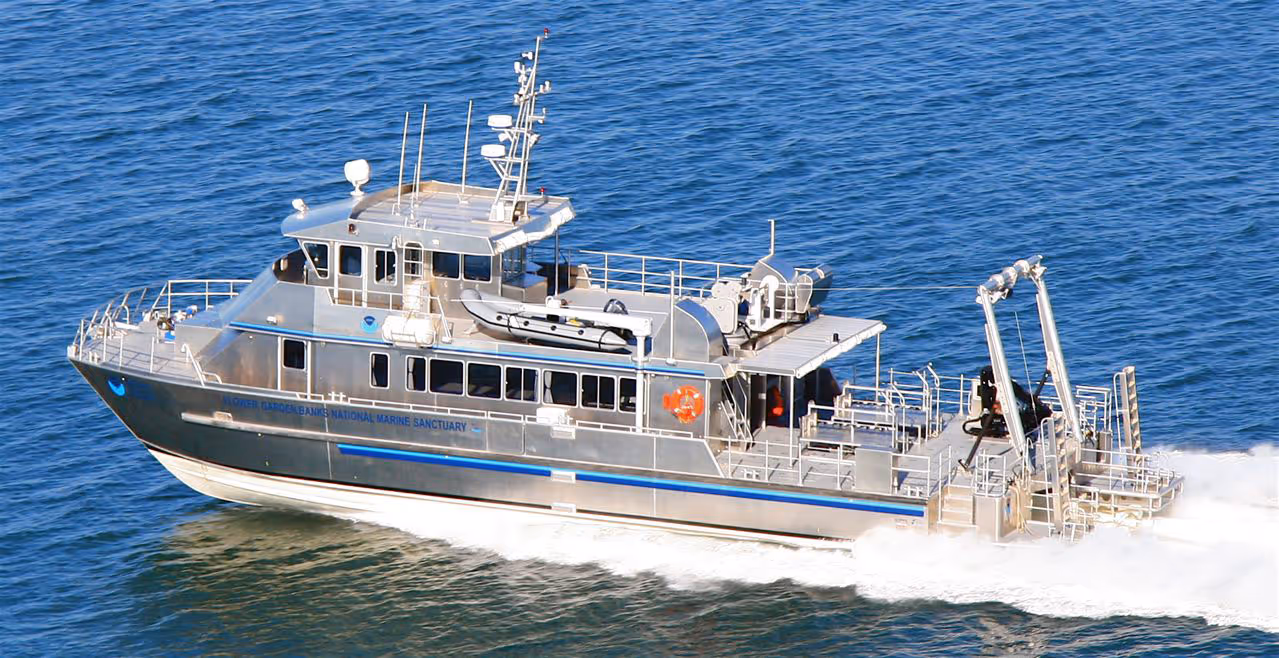
The sanctuary's remoteness defines nearly every operational decision. A trip to the banks aboard the sanctuary research vessel takes 10 to 12 hours in good weather, with the team typically departing the night before and arriving around dawn. Weather windows are unpredictable, staffing is limited, vessel costs are high, and fuel is expensive. When the team does reach the site, they try to accomplish as much work as possible because the next opportunity may be weeks or months away.
For a site that NOAA is mandated to monitor and protect, this creates a fundamental tension: the sanctuary produces annual long-term monitoring reports (in partnership with the Bureau of Ocean Energy Management) that require continuous environmental time series, but the logistics of reaching the site make continuous data collection extraordinarily difficult.
Before Spotter, the sanctuary relied on data loggers deployed on the reef. These instruments recorded temperature and water quality parameters reliably, but they stored data internally with no real-time telemetry. To retrieve the data, a dive team had to travel to the site, descend to the instruments, and physically recover them.
The result was a monitoring program shaped more by logistics than by science. If weather, vessel maintenance, or funding prevented a trip, the data stayed on the logger. Annual reports sometimes contained gaps, not because the instruments had failed, but because the team simply hadn't been able to reach them. Processing timelines stretched from weeks to months as recovered data queued up for download and analysis.
The sanctuary also lacked any real-time sea-state information at the banks themselves. For recreational and commercial boaters making the long run offshore, conditions at the site were unknowable until arrival. Predictive models offered some guidance, but 100 miles from shore, the difference between a forecast and reality can be significant.
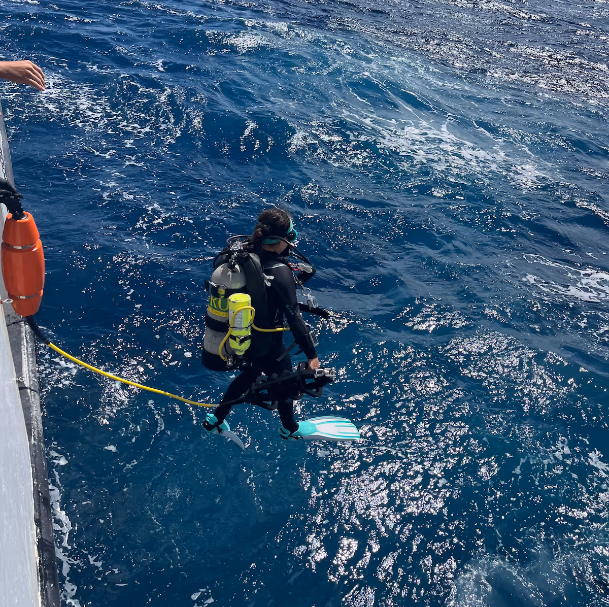
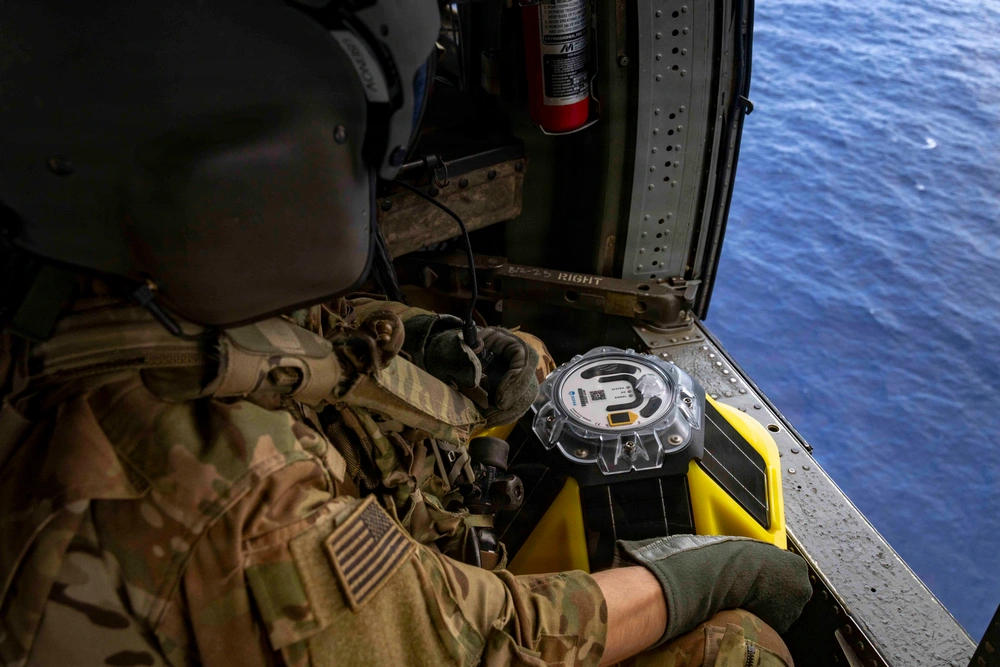
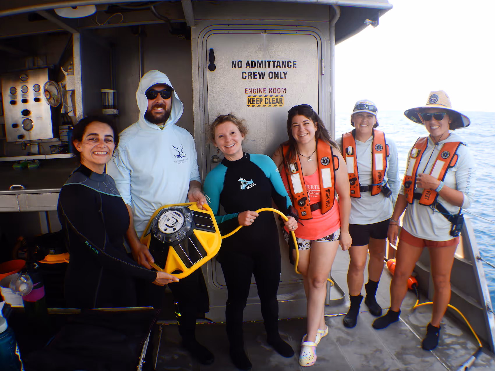
The sanctuary's first Spotter arrived courtesy of the National Marine Sanctuary Foundation and was deployed at East Flower Garden Bank with two temperature sensors on a Smart Mooring. The deployment method fit naturally into existing operations: divers attached the mooring to pre-installed anchors during regularly scheduled research trips, requiring no specialized vessel or additional logistics.
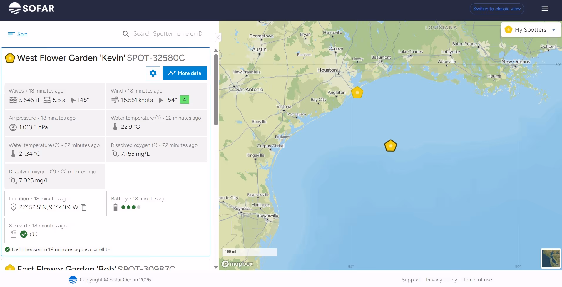
The shift from stored to streamed data was immediate. Temperature readings from both the surface and reef crest began transmitting in near real-time via satellite, feeding directly into the Sofar Ocean Spotter Dashboard. For a team accustomed to waiting months for instrument recovery, having a continuous data stream from 100 miles offshore changed the cadence of their science.
A collaboration with Florida Keys National Marine Sanctuary (which already operated several Spotters) brought a second buoy to West Flower Garden Bank, this time equipped with Sofar dissolved oxygen sensors on the Smart Mooring. With temperature and DO streaming from two depths at the western site, the team could begin comparing environmental conditions across the two primary banks in near real-time for the first time.
The platform's modularity was a key factor. The ability to configure Smart Mooring sensor packages to match each site's monitoring priorities (temperature at one bank, temperature and dissolved oxygen at another) allowed the team to build capability incrementally without replacing the core platform.
The most direct impact has been on the sanctuary's core scientific output. Annual long-term monitoring reports now draw on complete time series rather than data punctuated by logistical gaps. Processing timelines that once stretched from weeks to months have compressed to days. Fewer vessel trips are needed solely for instrument recovery, with estimated savings of up to $75,000 in reduced vessel operations.
But the data's reach extends well beyond the sanctuary's own reports. The team has built a network of data pathways that amplifies the value of each Spotter measurement across multiple audiences and applications.
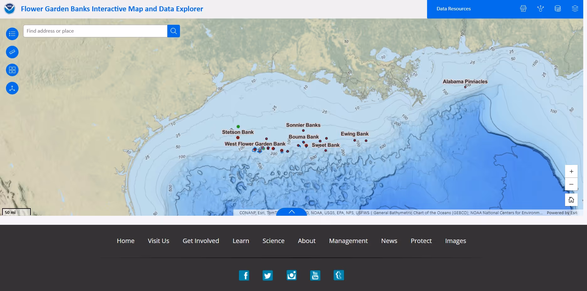
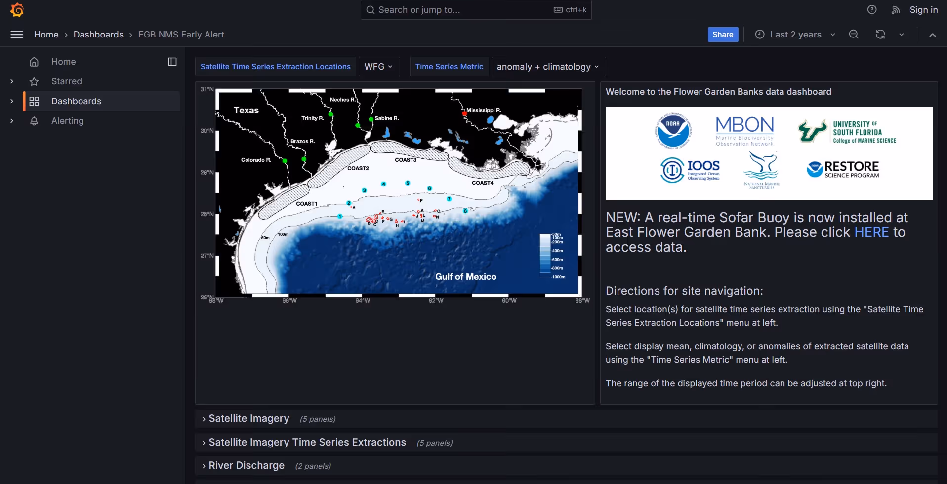
The Spotter Dashboard is publicly accessible, linked directly from the sanctuary's website. Through the API, Spotter data also feeds a custom partner dashboard developed by Florida State University, and flows to NOAA's National Centers for Environmental Information (NCEI) for permanent archival via the GCOOS program. The data is connected to Aqualink, expanding its availability to the broader reef monitoring community as well as Sanctuary Watch, an interactive IOOS tool where the public can explore habitat conditions, species trends, and ocean data across the sanctuary.
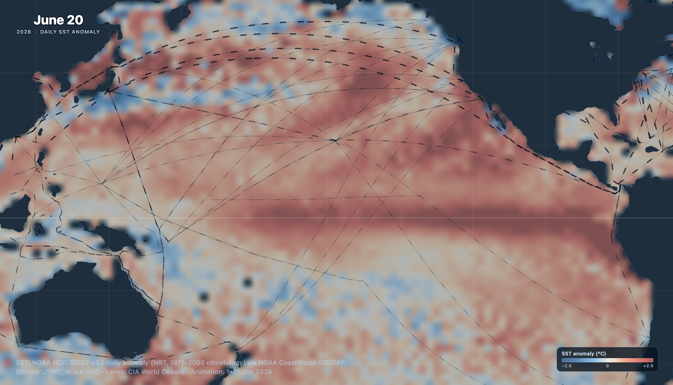
Perhaps the most striking downstream use emerged unexpectedly. NOAA's National Hurricane Center, through its Tropical Analysis and Forecast Branch, independently began pulling publicly available Spotter buoy data and feeding it into models that support predictive forecasting for the Gulf. The sanctuary learned of this only when a researcher there reached out to collaborate, a discovery that reinforced the compounding value of making localized ocean data publicly available.
For the recreational fishing community, the impact has been more personal. Boaters planning the long run to the Flower Garden Banks can now check real-time sea state conditions before committing to the journey. Even at speed, recreational vessels face a 3.5-to-5-hour transit each way, and that information can shape the decision to go or stay. The public response has been strongly positive.
The sanctuary expanded from three protected bank sites to 17 in 2021, creating a monitoring mandate that far outpaces the original two-buoy deployment. New funding through the GCOOS program, totaling $600,000 over five years beginning in mid-2026, will support the expansion from two Spotters to four, with deployments planned at Stetson Bank (70 miles offshore) and Bright Bank (the next easternmost site in the chain).
All future systems will carry Spotter dissolved oxygen sensors as a baseline, providing temperature and DO measurements across the network. The team is also evaluating current meters (valuable for diver safety assessments before operations), passive acoustic monitoring (for tracking both ecological health and vessel activity in the sanctuary), and salinity sensors.
The five-year funding structure provides stability for sustained monitoring while allowing flexibility to incorporate new sensor capabilities as the Spotter ecosystem evolves.
What began as a single buoy filling gaps in an annual report has become something larger: a real-time data network that serves NOAA scientists, hurricane forecasters, reef conservation partners, and the boating public alike. For a sanctuary defined by its remoteness, that reach is the point. The Flower Garden Banks will always be 100 miles from shore. The data no longer has to be.
Explore our Spotter Configurator to see how you can create your own system.

.avif)