Samoa Meteorology Division is the national met service for Samoa, responsible for the forecasts and marine warnings that fishers, boat operators, and coastal communities depend on.
Working with the Secretariat of the Pacific Regional Environment Programme (SPREP), the division recently deployed a network of Spotters around Samoa. The deployment was made possible by the European Union-funded Climate Services and Related Applications (ClimSA) Pacific programme.
On Wednesday 7 October/Tuesday 6 of October, Emmanuel Etimani and Mattaniah Salesa of Samoa Meteorology Division joined Sofar Ocean to talk about how the project came together and how the Spotter data will support the community of Samoa.
We covered:
Speakers
Wednesday 7 October 2026 | 11:00 Samoa (UTC+13) | Tuesday 6 October, 15:00 PT
What is a Spotter Smart Mooring?
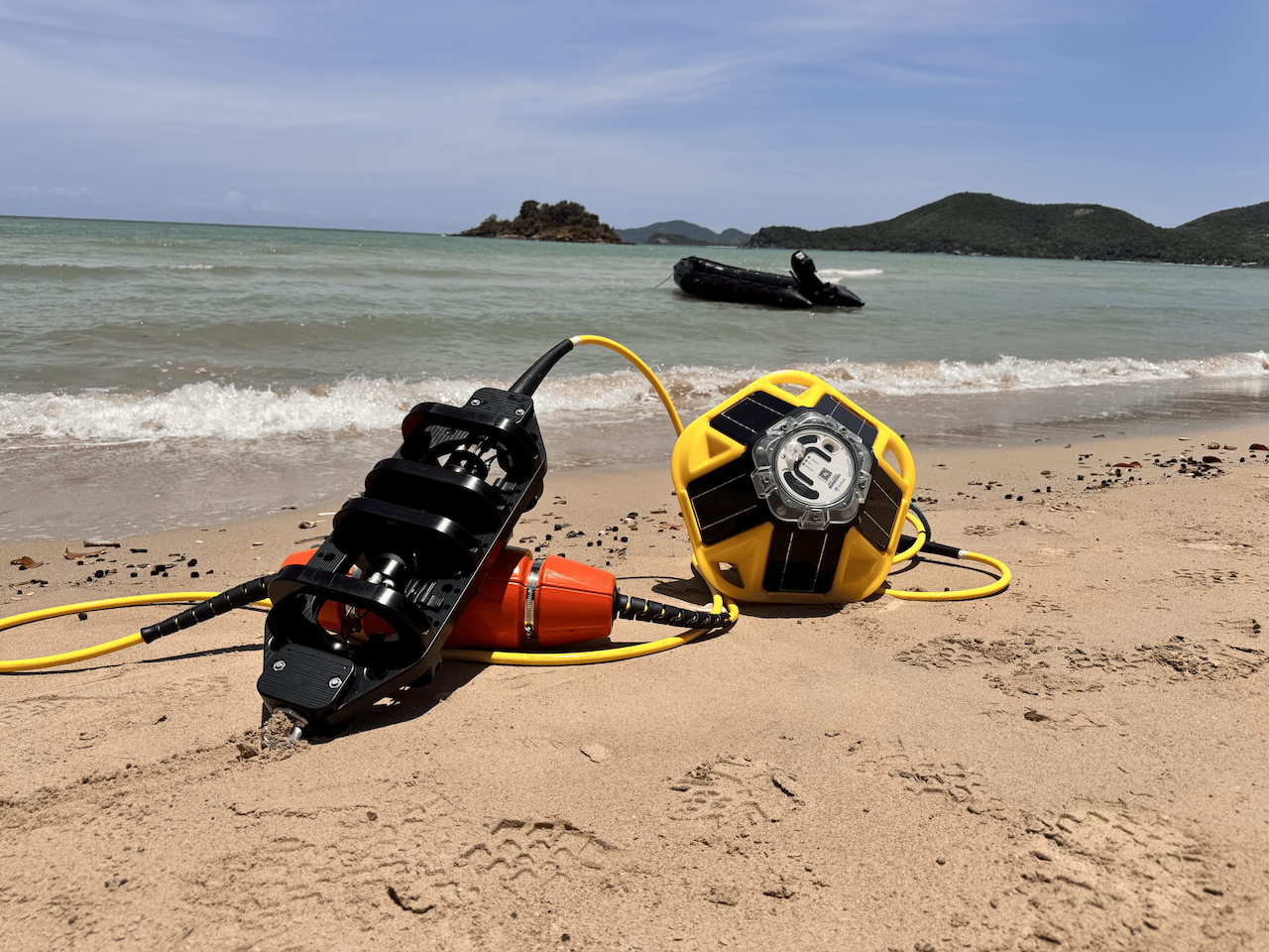
A Spotter Smart Mooring is an ocean monitoring system that pairs a Spotter surface buoy with a mooring line of sensor nodes at depth, sending surface and subsurface data in real time. The system is solar powered and built for water depths of about 50 meters. Sensor nodes can be swapped to fit each deployment.
How does a Spotter buoy deliver real-time ocean data?
Spotter sends its measurements in real time to the Spotter dashboard and through an API. Surface and subsurface readings arrive on the same timestamp, so users can see what is happening in the water column without waiting to recover the instrument.
What does a Spotter ocean buoy measure?
A Spotter buoy measures surface conditions including significant wave height, wind, barometric pressure and sea surface temperature. Adding a Smart Mooring extends those measurements below the surface.
How is Samoa building an ocean sensor network?
The Samoa Meteorological Services is building its ocean sensor network with 10 Spotter Smart Mooring systems, funded through the EU's CLIMSA program. The agency asked for ocean data after Samoa's sectors and communities, including fisheries and agriculture, said they needed it.
How does ocean buoy data improve marine weather forecasts?
The Samoa Met Office's weather and forecasting team checks its marine forecasts against live readings from its Smart Mooring buoys. Comparing forecasts with measured conditions shows the team how accurate its forecasts are.
How can ocean buoy data help monitor El Niño?
Real-time sea surface temperature readings let forecasters check whether their El Niño outlooks match conditions in the ocean. The Samoa climate team compares ocean and land readings because this year's El Niño has behaved differently from its forecasts.
What is the European Union's ClimSA program?
European Union's ClimSA program is an EU-funded program that helps Pacific Island countries strengthen climate services and improve climate data, monitoring and decision making. In Samoa, CLIMSA funded the Spotter Smart Moorings and many of the agency's land-based weather stations.
How is a Spotter buoy deployed?
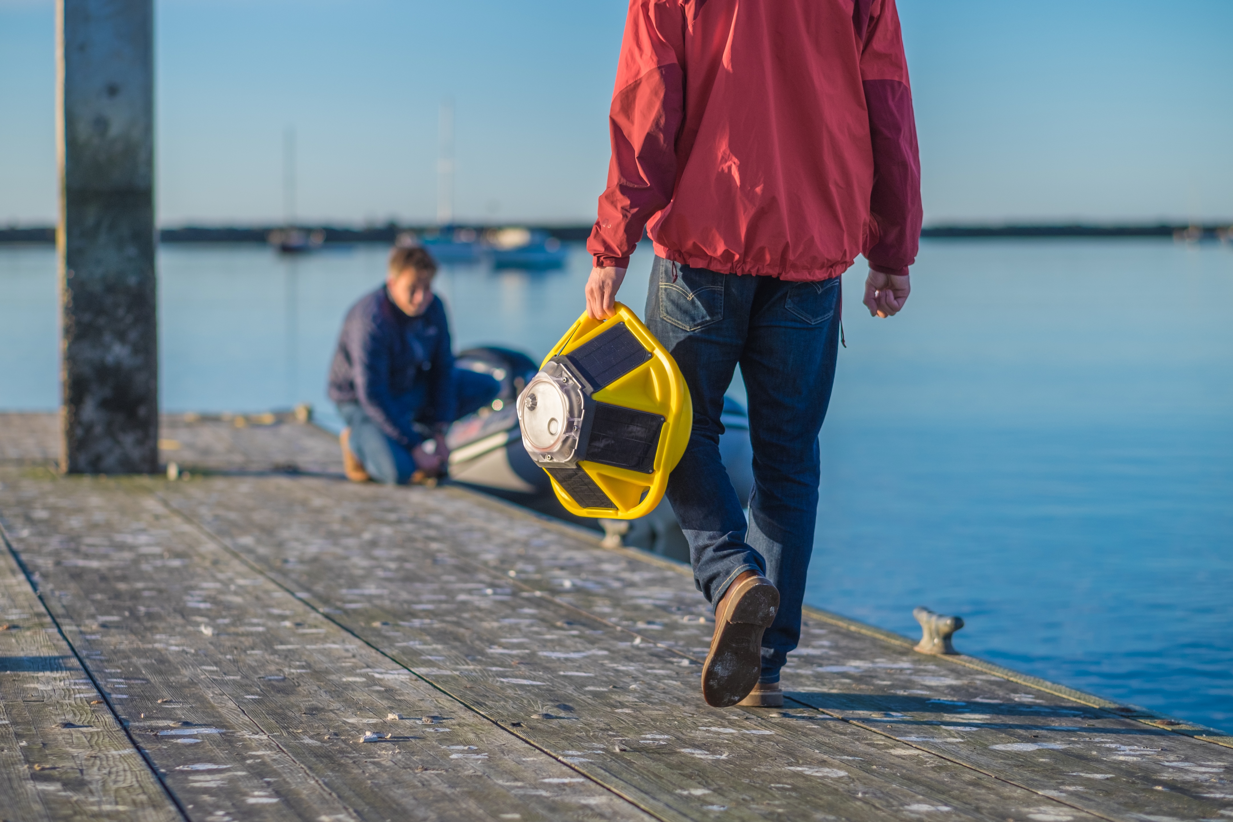
A Spotter buoy is about the size of a basketball and can be deployed in minutes from a small boat, with no specialized crew or vessel. In Samoa, the Sofar team trained Met Office staff on site, and the agency's own team carried out the first deployment.
How does Spotter compare with traditional ocean moorings?
Traditional moorings are large, expensive and need specialized crews and vessels, and each one measures a single point. Spotter's lower cost and simpler deployment make it practical to build a network of buoys, giving wider coverage across an area and continuous real-time data.
Do Spotter buoys need battery replacements?
No. Spotter buoys run on solar power, not batteries, so they operate continuously as long as they get enough sunlight. There are no batteries to swap.
Can a Spotter buoy be tracked if it goes missing?
Yes. Every Spotter buoy reports its GPS location to the dashboard. When one of the Samoa Met Office's buoys was taken, the team used its location to find and recover it.
Will Samoa's ocean data be publicly available?
Not yet. The Samoa Meteorological Services is working with Sofar on plans to share the data with Samoa's sectors and communities once more buoys are deployed.