
MPA managers draw on a mix of methods — satellite imagery, field surveys, acoustic monitoring — but underpinning any program is the persistent, in situ sensing infrastructure that provides continuous ground-truth from the water itself, feeding a shared operational view alongside every other source a manager relies on.
Spotter is Sofar Ocean's platform for that sensing layer. It delivers continuous ocean data from any location in a protected area to a single cloud dashboard, whether the source is a compact buoy moored at a reef, an uncrewed surface vehicle (USV) monitoring marine mammal acoustics across a sanctuary, or a free-drifting unit tracking a current.1,2 Every form factor runs on solar power, connects via satellite, and streams to the same dashboard and API.3
Spotter is not a traditional oceanographic buoy made smaller. It was designed from the start to work as part of a network: affordable enough to deploy at multiple sites, simple enough to maintain without marine engineering expertise, and connected enough that every unit feeds the same operational picture.
The Spotter Platform
A turnkey, all-in-one solution for real-time ocean data. From moored buoys to mobile vessels, every Spotter streams to the same dashboard and API.
Fixed-Point Ocean Monitoring
Moor in up to 50m of water for continuous surface and subsurface data. Measure waves, wind, and weather at the surface while extending sensing below with Smart Mooring sensors.
Spatial Survey & Gap Filling
Transit between locations to measure how conditions vary across a region. Fill coverage gaps or scout new deployment sites.
Lagrangian Monitoring
Follow currents to track conditions as they move. Deploy a Spotter buoy as a free drifter or use a Spotter Scout with return-to-home-capability.
Deep Water Station Keeping
Hold position in water of any depth without a mooring. Configure station-keeping from 50m to 10km radius. 6+ months of unattended operation.
Persistent presence at critical sites
A moored Spotter holds station at a fixed location: a coral reef under thermal stress, the boundary of a no-take zone, a nursery habitat for a protected species. Anchored in place, it measures wave conditions, sea surface temperature, and barometric pressure continuously, and derives wind speed and direction from the high-frequency portion of the wave spectrum.1 Solar power keeps it running without battery swaps or fuel. Satellite and cellular links transmit observations in near real time, so conditions at the site are visible on a dashboard within minutes, not months.
There are no data loggers to retrieve, no scheduled field visits required to access what the buoy has recorded. If wave conditions spike beyond safe operating limits for small-vessel operations, the alert arrives while there is still time to stand down a patrol. If a sudden temperature swing signals a change in local oceanographic conditions, the manager sees it that day rather than discovering it in a quarterly data download. The buoy is always there, always reporting.
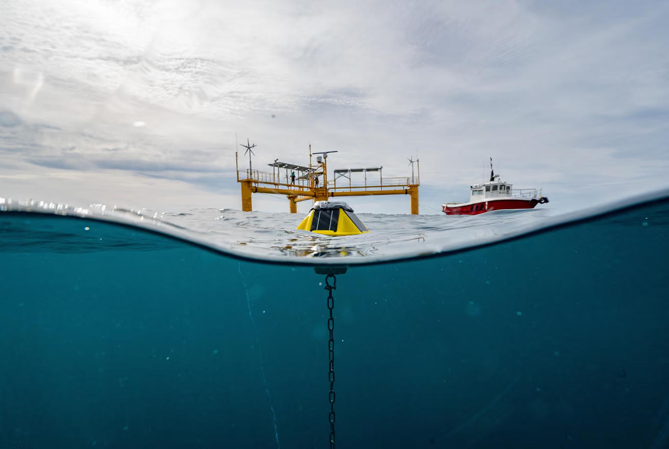
the cost of a traditional oceanographic buoy. Spotter's compact form factor and hand-deployability mean MPA programs can place monitoring at multiple sites for the budget that would previously cover one.
Sofar sales materials describe the Spotter as costing 10× less than traditional platforms.4With Spotter priced below $5,000 per unit5and traditional oceanographic buoys ranging from tens to hundreds of thousands of dollars, the cost ratio enables network-scale deployment for the first time.
Seeing below the surface
Surface conditions tell part of the story. But many of the questions that matter most to MPA managers live below the waterline: how water temperature changes with depth, whether dissolved oxygen levels are dropping near the seafloor, what current patterns look like through the water column, and what species are present based on underwater sound. The Smart Mooring extends Spotter's capabilities from the surface to the seafloor.
The Smart Mooring is a Kevlar-reinforced cable available in six discrete lengths (5, 10, 20, 25, 35, and 50 meters) that can be connected together to reach the required depth.6,7 It replaces a conventional mooring line while delivering both power and data connectivity from the Spotter buoy at the surface to up to three sensor nodes distributed along the water column. Sensors connect via Bristlemouth, an open connectivity standard developed with support from DARPA, the Office of Naval Research, and NOAA.8,9,10 The principle is similar to USB: a single standardized connector that allows sensors from different manufacturers to plug in, exchange data, and draw power without custom engineering.11 Temperature sensors, dissolved oxygen instruments, current meters, water level gauges, and hydrophones all connect the same way.
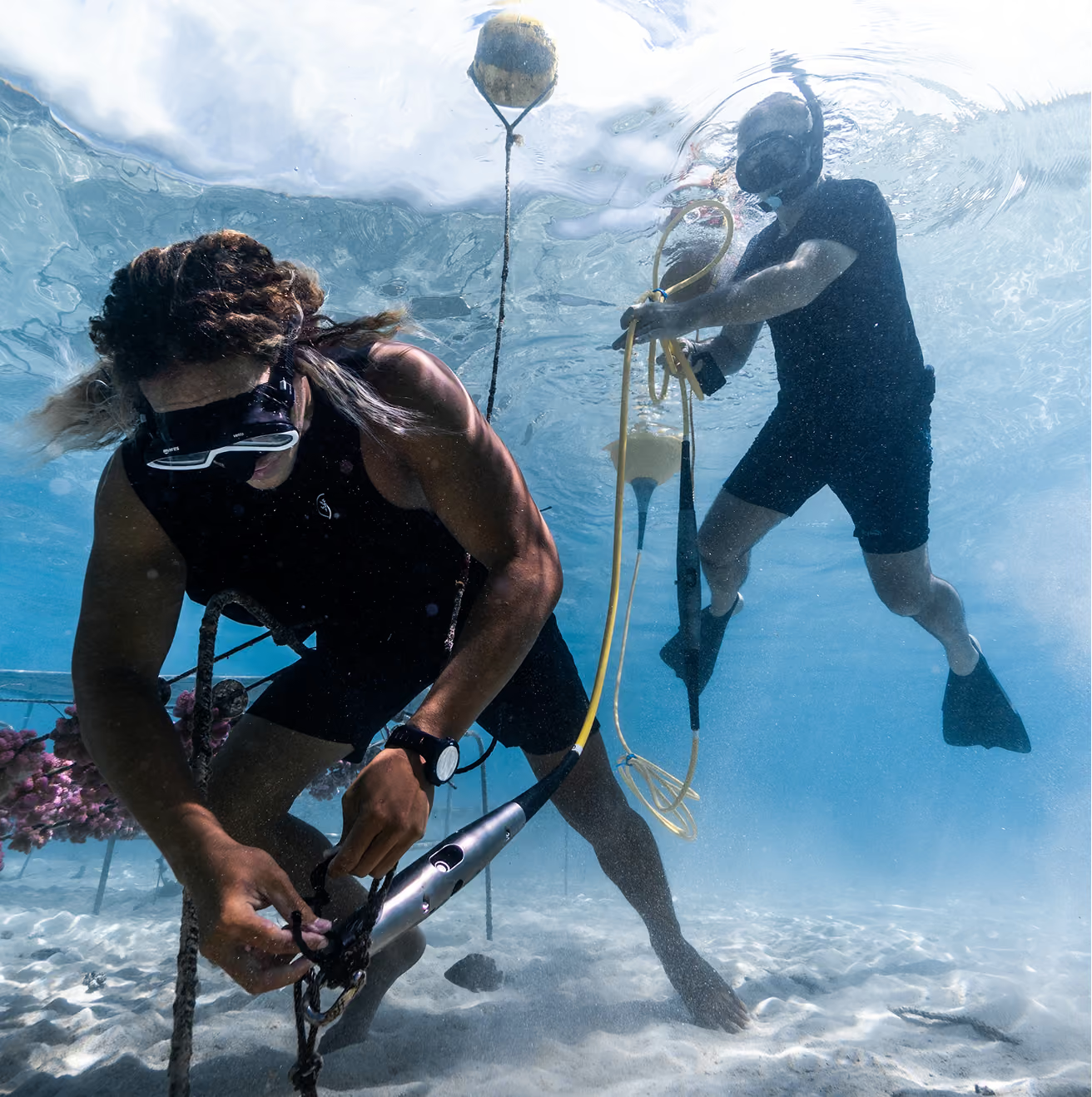
The practical result for an MPA manager: a single Spotter with Smart Mooring replaces what would otherwise be a cluster of disconnected instruments, each with its own data logger, its own retrieval schedule, and its own data format. All subsurface measurements flow through the buoy and transmit to the same dashboard alongside surface data. When monitoring priorities change, sensors can be swapped in the field without replacing the cable or the buoy. The infrastructure stays; the capability adapts.
Filling the gaps between fixed stations
Moored Spotters provide persistent coverage at specific locations. But an MPA can span thousands of square kilometers, and anchoring a buoy at every point of interest is neither practical nor affordable. Some areas are too deep for conventional moorings. Others need monitoring only during certain seasons or in response to specific events. Spotter Scout addresses these gaps.
Scout is a 2.4-meter autonomous surface vehicle, compact enough for a single person to launch from a boat ramp or vessel. Once deployed, it can station-keep at a designated location, transit between sites on waypoint-based missions, or follow programmed survey routes. Solar power and a 2 kWh battery give it over six months of continuous, unattended endurance.12,13
For MPA monitoring, Scout's most relevant capabilities are spatial survey and gap filling: transiting between moored stations to measure gradients and validate conditions across a region, or holding position at a deep water site where mooring would be impractical. It can also serve as a subsea-to-satellite gateway, receiving acoustic transmissions from seabed instruments and relaying the data to the cloud without any fixed infrastructure connecting the seafloor to the surface.12,13
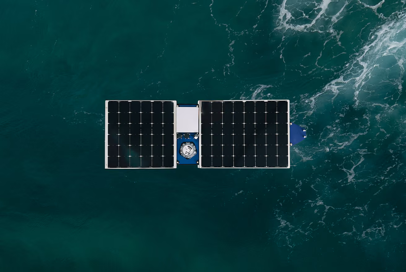
of continuous autonomous operation on solar power, enabling long-term monitoring without routine field visits.¹²˒¹³
One platform for every deployment
Whether the data comes from a moored Spotter, a subsurface sensor on a Smart Mooring at 40 meters depth, or a Scout on a survey transect, it all arrives at the same place: the Spotter Dashboard and API. There is no second system to log into, no separate data format to reconcile, no retrieval mission to plan. Surface conditions, subsurface measurements, and mobile survey data appear together in a single operational picture.
The dashboard provides real-time and historical data access, configurable alerts when conditions cross defined thresholds, and remote device management. Sampling rates, alert settings, and firmware can all be updated without visiting the deployment site. For organizations that need to integrate ocean data into existing systems, the REST API provides programmatic access to every data stream the platform produces. Data is always accessible, always downloadable, and always portable.
Start with one, build a network
A single moored Spotter at one critical location gives an MPA manager continuous intelligence from that point. A second unit at another site reveals how conditions vary across space. Add Smart Mooring and the picture extends below the surface. Deploy Scout and the gaps between fixed stations get measured. Each addition compounds the value of the others, because every unit feeds the same dashboard, the same API, and the same operational picture. The platform scales with the manager's needs and budget, from a single point of observation to a network that covers an entire protected area. The chapter that follows shows what that looks like when real teams put it into practice.
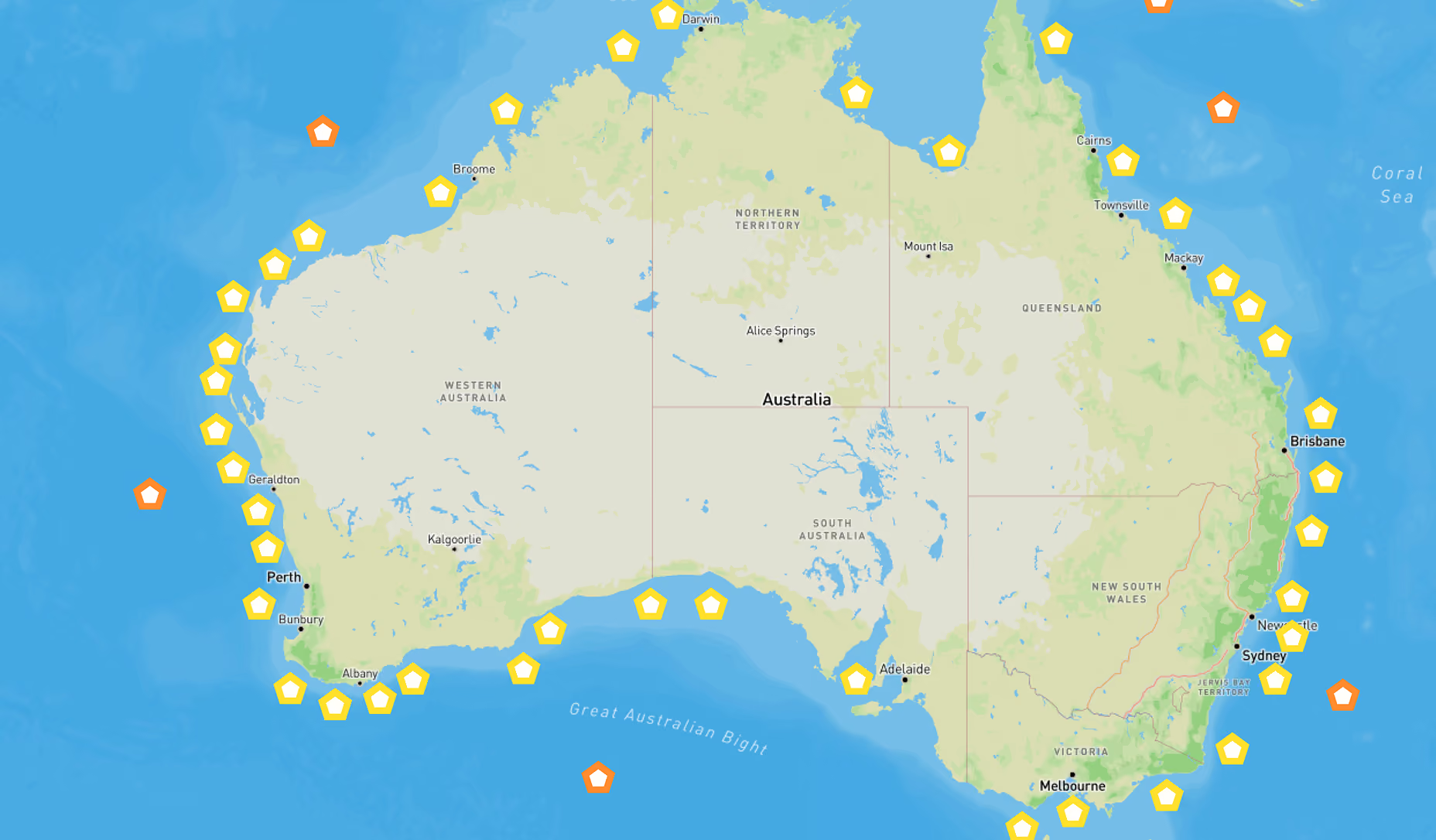
1. Sofar Ocean. Spotter Buoy — Specifications
2. Sofar Ocean. Spotter Platform Spec Sheet (April 2025).
3. Xylem/Sofar Ocean. Spotter Data Sheet.
4. Sofar Ocean. Spotter & Smart Mooring Sales Presentation (2024). States “10× lower costs vs. traditional platforms.”
5. The Maritime Executive (2020). Small, cheap metocean buoys expand coverage of high-res wave data. Reports Spotter at less than $5,000 per unit
6. Sofar Ocean. Spotter with Smart Mooring — Specifications. Confirms available cable lengths of 5, 10, 20, 25, 35, and 50 meters; up to three subsurface sensor nodes.
7. Sofar Ocean (2021). Introducing Spotter Smart Mooring. Confirms single Kevlar-reinforced cable carrying power, data, and mechanical fastening.
8. Bristlemouth. An open standard delivering plug-and-play hardware interfaces for marine applications.
9. PRNewswire (2021). Sofar Ocean debuts Bristlemouth at OCEANS 2021 with partners DARPA, the Office of Naval Research, and Oceankind.
10. MITRE (2025). MITRE to lead ocean technology standards work. Confirms Bristlemouth is funded by Sofar Ocean, MITRE, NOAA, and DARPA.
11. RBR Global. RBRcoda³ sensors added to Sofar Ocean Smart Mooring platform. Demonstrates multi-manufacturer sensor interoperability via Bristlemouth.
12. Online Oceans. Scout — Product page. Confirms 2.4 m length, solar arrays with 2 kWh battery, 6+ month endurance, single-person deployment, station-keeping, and subsea-to-satellite relay capability.
13. Online Oceans. Homepage. Confirms waypoint-based missions, station-keeping, and subsea-to-satellite data relay at a fraction of traditional costs.